FIRST WARN FORECAST: Tuesday brings extreme cold and snow, some get much more than others
KANSAS CITY, Mo. (KCTV) - Tuesday remains our highest alert, a First Warn Weather Day, due to a dangerous combo of accumulating snow and record-shattering cold.
Starting with the snow, there are two rounds that each bring accumulation. The first is overnight, then a lull, then the main round from roughly 9 a.m. through 6 p.m. Tuesday. Waking up Tuesday morning, we likely see about 1″, though 2″ in a few spots are possible. The morning drive will be slowed by the fresh snow, but we may be in the quiet lull between rounds for the heart of the rush hour.
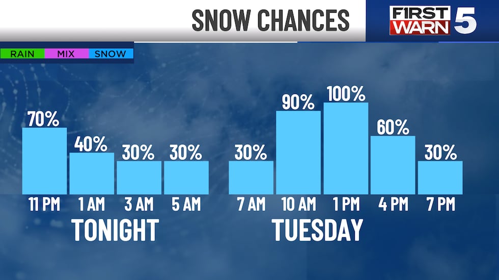
Snow looks to pick back up mid-morning and last through the evening rush before tapering off. The evening drive will likely be worse than the morning, as snow will be stacking up through the day. It will be light and powdery snow, so it will be easy to shovel and plow. No ice is expected. The snow should be over across the area by 9 p.m.
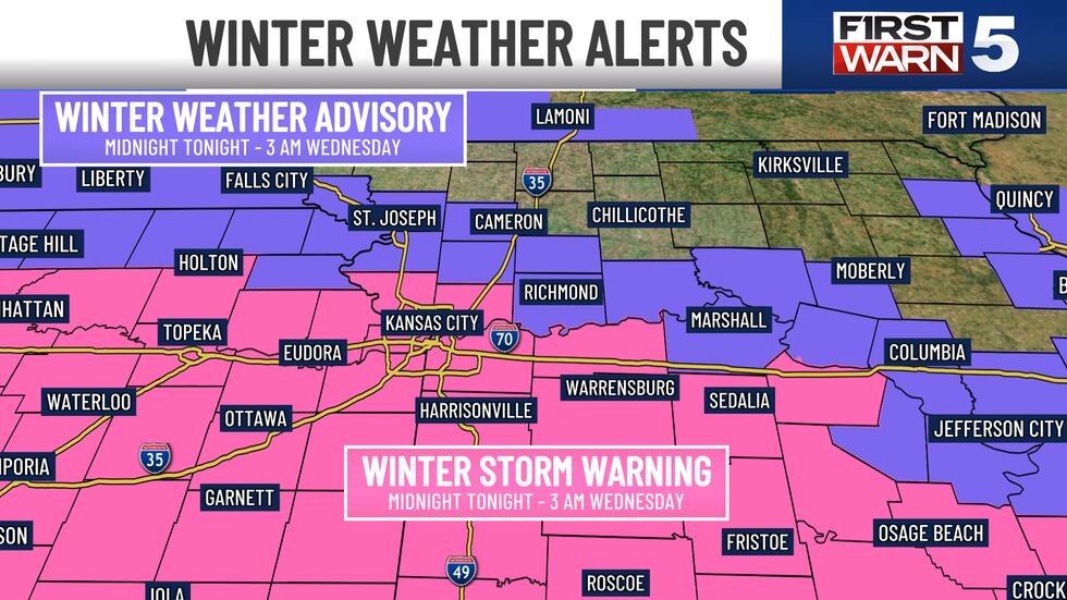
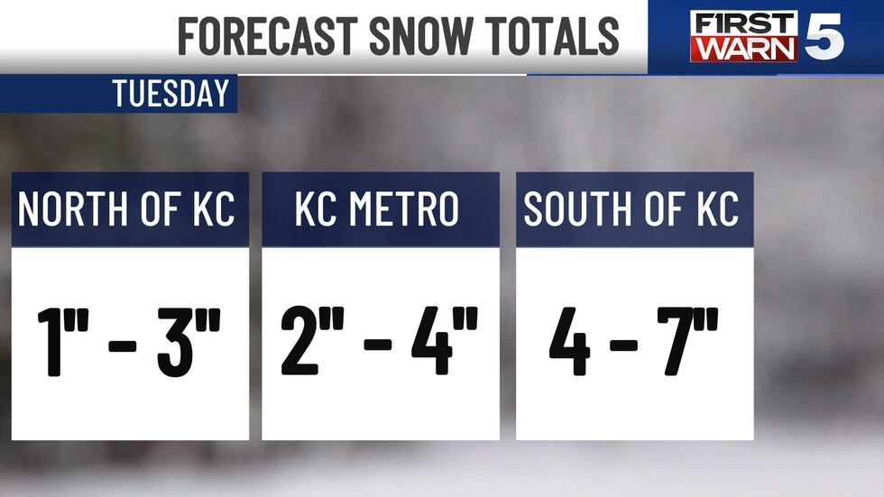
Snow totals will be highest south of Kansas City and lowest north of the metro. In general, 1-3″ is expected north of Kansas City. This area is under a Winter Weather Advisory through 3 a.m. Wednesday, which is a lower-tier alert due to the lesser snow expected here.
Kansas City and points south are under the higher tier Winter Storm Warning through the same time, where more snow is expected. For the metro, a range of 2-4″ is likely. The heaviest snow will be south of Kansas City, where 4-7″ is expected. There will likely be a sharp change in snow over short distances, and we may even see big differences from the north side of Kansas City to the south side.
For First Warn 5 Radar, click here.
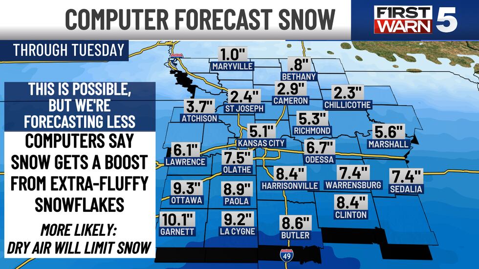
It should be noted computer forecasts are projecting higher snow totals than we are forecasting, with 5-6″ for the metro. While this is possible, it is not likely. The computers are saying that the snow will get a boost from the flakes being extra-fluffy and that they will stack up like popcorn instead of potato chips. More likely, since the air is so cold, it will be very dry. Dry air tends to reduce how much snow we get, which is why we are forecasting on the lower end.
While the snow gets a lot of headlines, it is the cold that will be most memorable and dangerous about this event. This is record-shattering cold for three straight days. Tuesday, Wednesday, and Thursday highs are all records... by a lot. Highs won’t get past 10 these days. Friday is close to a record with 20. Wednesday through Friday mornings are all record cold lows, each from -4 to -12. The wind chills will range from -20 to -30 during these mornings. Each of these days continue to be First Warn Weather Days due to the extreme cold.
There is good news in that we turn a corner for the better by the weekend. We will be in the mid-40s by Sunday, with mid-50s to 60s expected next week.
To get the latest weather updates sent to your phone, the KCTV5 Weather app here.
Copyright 2025 KCTV. All rights reserved.


