FIRST WARN WEATHER DAY: Windy & warm Tuesday, severe storms possible
Tuesday is a First Warn Weather Day, our highest alert, as strong to severe storms look to push through in the evening and overnight. While there is potential for large hail and damaging winds, we could also see a few isolated tornadoes. It will be a day to remain informed, and we will bring you updates every step of the way to keep you ready for them.
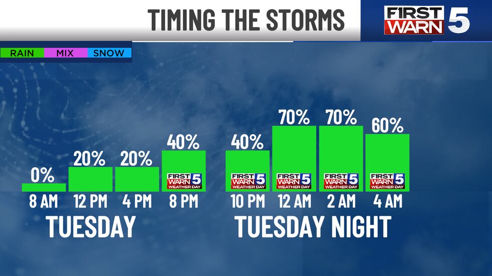
We will have lots of dry time Tuesday before storms ever move in. The morning will be on the chilly side with temperatures near sunrise at 40. The afternoon is mild, but it will be windy with southeast gusts as high as 40 mph. Most of the day will be cloudy, and we could see a few spotty afternoon showers.
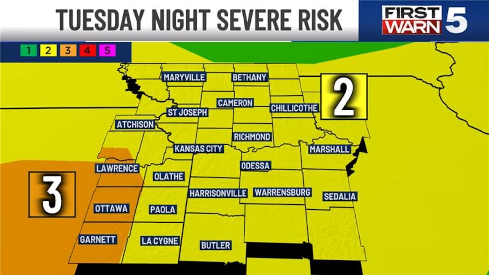
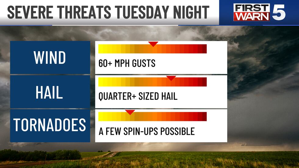
The risk for severe weather comes in as early as 8 p.m. Tuesday. The Kansas City metro and much of the area is under a Level 2/5 risk for severe weather, but we do have eastern Kansas from Lawrence to Ottawa and Garnett under a higher Level 3/5 risk. The most likely severe impacts would come from pockets of hail to the size of quarters or larger and damaging winds of 60+ mph. But, there is a chance for some storms to rotate and bring a tornado risk. That risk is less likely, but possible.
The storms may come in two rounds, the first around 8-10 pm, which would be isolated storms near and southwest of Kansas City. We don’t know if these storms will even form, but if they do, they would be the most likely to bring a tornado risk. The second round will be a solid line of storms moving from northwest to southeast, arriving in Kansas City sometime around midnight (give or take). This line brings a primary risk of hail and wind, but it also has a low tornado risk.

Everyone is likely to get rain Tuesday night, but not everyone will get severe weather. It will be confined in pockets where the strongest cells occur. This line will be coming through while many are asleep, so it would be wise to keep your phone on to receive warnings, should you need to take action. The First Warn 5 Weather App will be geolocated to your house and only alert you if you are under an active warning.
The severe threat will end in Kansas City before sunrise Wednesday, but our eastern counties could see a few strong early morning storms before the area turns dry for the rest of the day. It will be warm with highs near 70.
The rest of the week brings cooler 50s and low rain chances. We have a First Warn on Saturday due to potential rain impacting plans outside. At the moment, the line of rain is along and south of I-70. If the system moves south, it could be a drier day... so it bears watching for updates if you have plans. Sunday may also see a few spotty showers, but it is no washout.
Copyright 2025 KCTV. All rights reserved.


