FIRST WARN WEATHER DAY: Be ready for storms, some may be severe into Wednesday morning
We have issued a First Warn Weather Day, our highest alert, through 8 am Wednesday due to the risk for strong to severe storms. These may come in a couple clusters, with the first overnight and the second into the morning. These storms may be severe in places, with hail and high winds the primary threats. That said, a few tornadoes cannot be ruled out.
OVERNIGHT: A cluster of storms that will be spotty in coverage move through until roughly midnight. Not everyone will get these, but a few of them could be severe. A Severe Thunderstorm Watch is in effect for our western and northwestern counties until 3 am, though this is likely to be expanded. The overall risk with these has been on the lower side, primarily being hail to the size of quarters and 60 mph wind gusts.
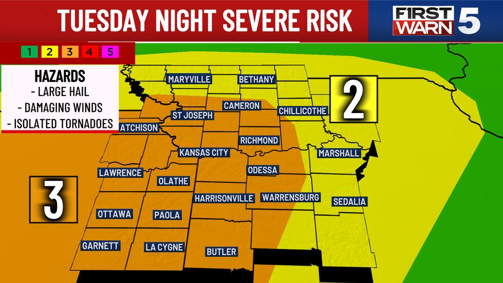
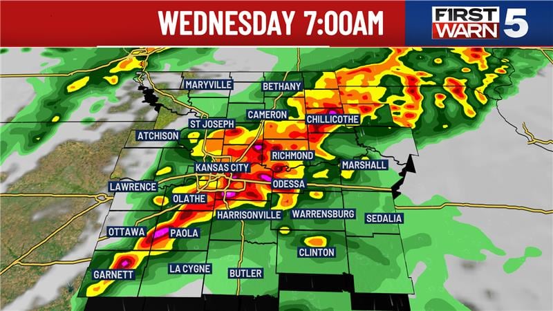
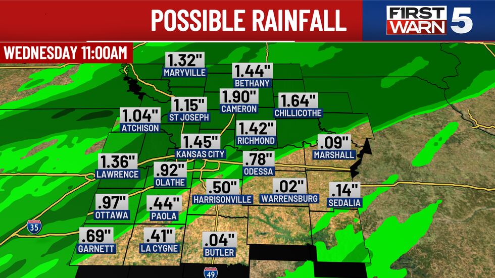
A second line of storms will be much more widespread and begin in northwestern Missouri and northeastern Kansas. This line will slowly move across the area from midnight through 8 am. The timing for the metro will be 4-8 am, so be ready for a stormy morning. This line will likely produce severe weather in some areas, with hail and damaging winds being the most likely impacts. In addition, brief spin-up tornadoes are also possible. Some areas may see heavy rain upwards of 2″ under strong thunderstorms, bringing a risk for isolated flooding.
LIVE BLOG: Tracking overnight storms in the Kansas City metro and surrounding area
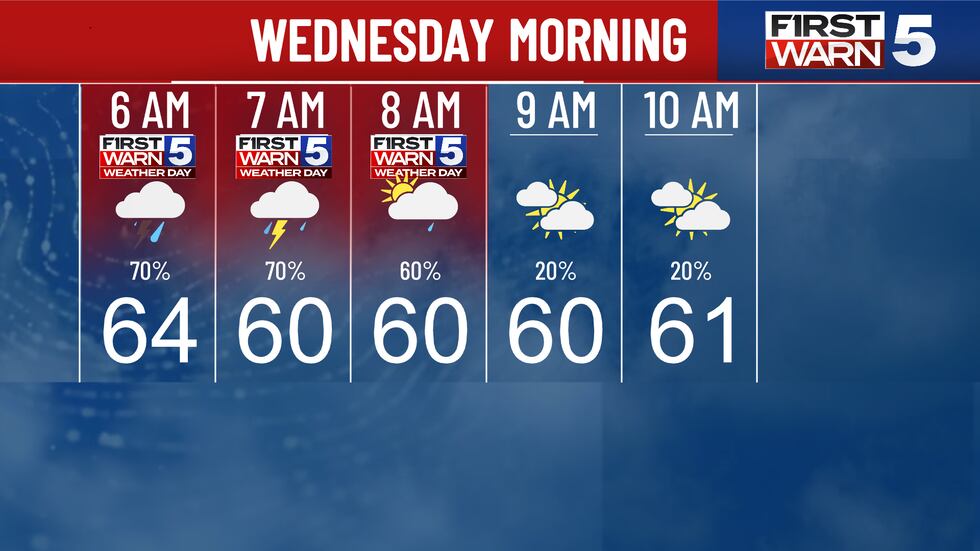
WEDNESDAY MORNING: Storms are likely to be ongoing around sunrise, with severe potential through 8 am. The early commute could be impacted by these. The storms move east of Kansas City after 8 am, and they will clear the entire KCTV5 viewing area by 11 am. Temperatures will start near 60.
WEDNESDAY AFTERNOON: The rest of the day will be dry with highs in the mid-60s and windy. Gusts from the southwest will range from 35 to 40 mph. Skies will be partly cloudy.
REST OF THE WEEK: Thursday will be cooler with highs in the upper 50s, cloudy skies and a low 20% chance for rain. We are First Warning that Friday may be wet, but severe weather is not expected. Highs will be in the mid-50s.
WEEKEND: Saturday has a First Warn due to scattered rain possibly impacting outdoor plans, though it may not be a washout. It will be breezy and cool with low 50s. Sunday has a rain chance, but it is lower than Saturday’s. Highs will again be in the cool low 50s.
To get the latest weather updates sent to your phone, the KCTV5 Weather app here.
Copyright 2025 KCTV. All rights reserved.


