First Warn Forecast: A First Warn for Friday, next dose of downpours arrives
KANSAS CITY, Mo. (KCTV) - Get ready for a chilly and wet stretch as we wrap up the week. This evening is cool and you may catch a brief and light shower, but many of us will remain dry. We are First Warning you that Friday is a different story, with widespread showers expected for a big chunk of the day.
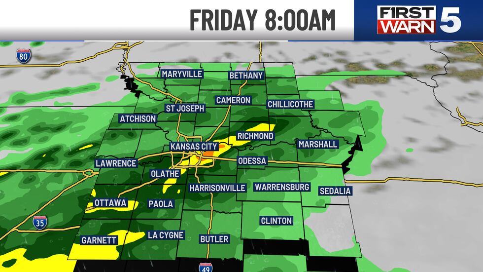
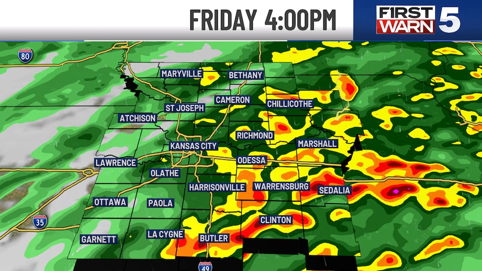
FIRST WARN FRIDAY: As these wet weather patterns continue, the Missouri River Valley rain chances will climb quickly, and by Friday, a scattered to widespread threat for rain and thunderstorms is possible. Some of these storms may be intense, with heavy rain and wind gusts between 30 and 50 mph. But it is unlikely we will see widespread severe weather. We anticipate a considerable amount of rainfall with Friday’s forecast leading to a half an inch of rain and another potential quarter of an inch into Saturday. Temperatures continue to fall into the lower 50s Saturday afternoon, with morning lows around freezing starting Sunday.
FIRST WARN SATURDAY: We keep the wet weather pattern for Saturday too with a 50% chance for rain and some isolated rumbles.
NEXT WEEK: A rebound in temperature will ensue as a new storm system begins to develop from the west and pump in warmer air by Tuesday, increasing temperatures to the upper 50s and then to the upper 60s by Wednesday afternoon. Scattered showers are possible if this pattern remains consistent, which may lead to another cooling trend by the end of next week.
To get the latest weather updates sent to your phone, the KCTV5 Weather app here.
Copyright 2025 KCTV. All rights reserved.


