FIRST WARN FORECAST: In & out of rain chances into the weekend
We have a somewhat gloomy and cool stretch of weather into the weekend, with First Warns in place to highlight outdoor plans may be impacted on Friday and Saturday. This will bring rain at times, though we will have plenty of dry time mixed between rounds of rain. It will also be abnormally cool for while. The good news; no severe weather is in the picture for now.
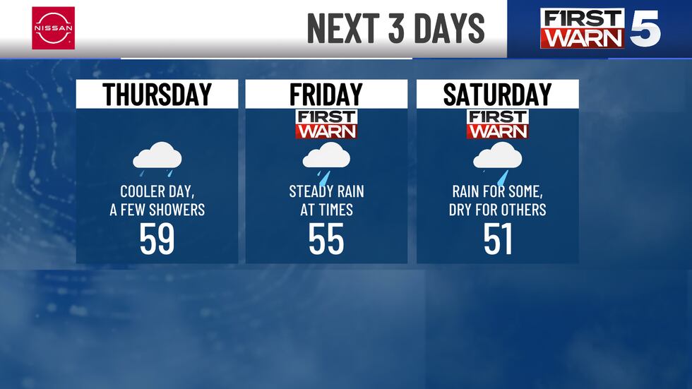
THURSDAY: New information is pointing to scattered morning rain. This is a flip from earlier forecasts, which had spotty rain more for the afternoon. Regardless, it will be hit and miss in coverage, so not everyone may see it. It will be cool with morning temperatures in the mid-40s and the afternoon in the upper 50s. It will be cloudy with light east winds at 5-10 mph.
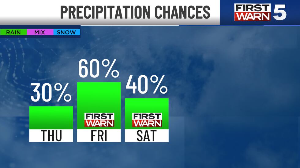
FRIDAY: We are First Warning of widespread rain, with the wettest part of the day being the morning. The afternoon will gradually see rain break up, and we look dry by evening. Highs will be in the mid-50s.
SATURDAY: Scattered morning rain is expected along and south of I-70, with the Kansas City metro right on the line. Those north of I-70 may skate through dry. The afternoon looks drier, though it will be windy and cool with highs only in the low 50s. Gusts from the north will range from 35 to 40 mph.
SUNDAY: Mainly dry with more sunshine, though still cool with highs in the low 50s.
We will continue to see cool weather into next week, with a possible freeze Tuesday morning. Warmer 60s finally return by the middle of next week.
Copyright 2025 KCTV. All rights reserved.


