First Warn Forecast: Lingering cloud cover, possibility of showers throughout Saturday
KANSAS CITY, Mo. (KCTV) - Showers are continuing to move through the area but staying south of I-70. These will continue to track to the north and east. The chance for a few isolated showers is still possible, mainly to the south and east of Kansas City. Once these move past, the rest of the day will be rather gloomy.
Another big talker will be the temperatures as we will reach a high in the upper 40s, and the winds will cause the feel-like temperatures to remain in the 30s and lower 40s. So make sure you are bundled up if you are heading outside today. The clouds will be blanketing the skies through the rest of today.
Sunday temperatures are a little warmer with some peeks of sunshine and another small chance for an isolated shower or two, but most areas will remain dry.
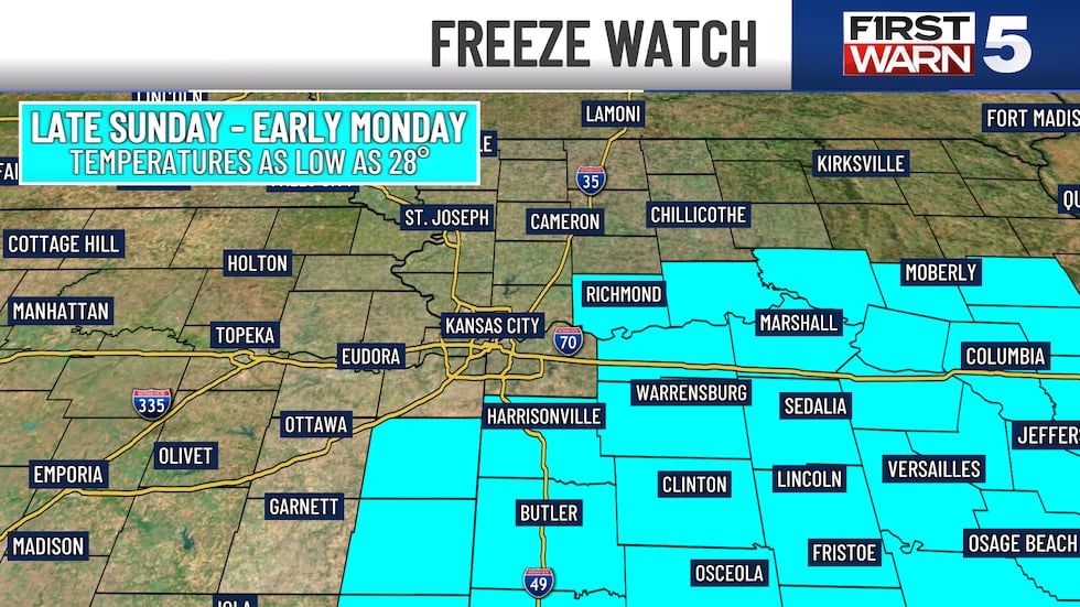
A Freeze Watch has been issued for counties southeast of KC from Sunday night through early Monday. Temperatures could dip down as low as 28 degrees in spots. Sensitive plants need to be covered or brought inside. Even though the KC metro is not currently included, we still think temperatures will dip into the lower 30s.
Heading into next week, temperatures will be slow to warm up, but the 70s will be back by the end of the week! There is a chance the winds will start to pick up by next weekend.
Beyond this weekend, the next chance for rain will be Wednesday into Thursday with only a small, 20 percent chance.
Copyright 2025 KCTV. All rights reserved.


