FIRST WARN FORECAST: The spring weather we’ve been waiting for is here!
A big spring surge in temperatures is here! The rest of this week will pack 60s and 70s, though there are a few spotty showers that may drift past some of our backyards.
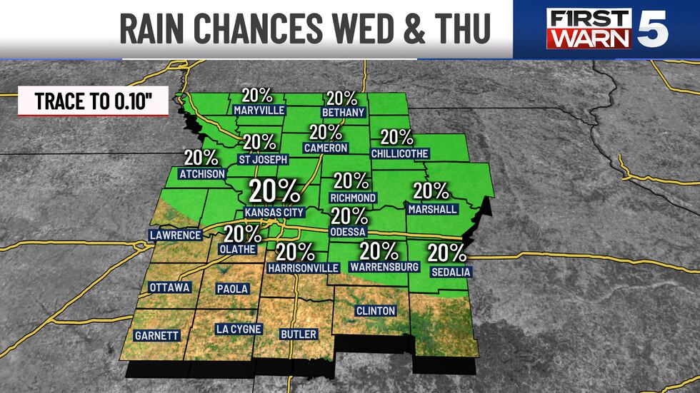
WEDNESDAY - Spotty light showers are possible until noon, though more of us will stay dry than see rain. If you do see rain, it will be brief and light. The morning is mild with temperatures near 50, and the afternoon is warm with mid-70s and west winds at 10-15 mph. Sunshine will take hold for the back half of the day.
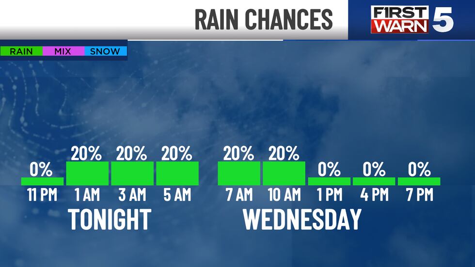
THURSDAY - It’s a repeat of Wednesday morning, with a few quick and light showers not out of the question. Any one backyard has a 20% chance to see them, so most of us will stay dry. The afternoon will be windy with gusts from the northwest 35 to 40 mph, and highs will be in the upper 60s.
FRIDAY - An excellent spring day, with sunshine and mid-60s. The winds will be lighter than Thursday.
WEEKEND - Saturday looks to be the pick day for plans outside. Highs in the low 70s, sunny skies, and fairly light winds make for an ideal day to be out. Sunday will be warmer, possibly the warmest day so far this year, with highs in the low 80s. While it will be dry, it will be quite windy with southwest gusts up to 40 mph.
Copyright 2025 KCTV. All rights reserved.


