Cool with clouds this Monday afternoon
KANSAS CITY, Mo. (KCTV) - We’re significantly cooler today with high temperatures only reaching the mid 50s to lower 60s. Mostly cloudy to partly cloudy skies are expected with winds gusting up to 25 mph. A few spotty showers will be possible through the late afternoon.
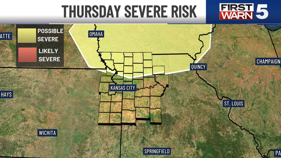
MIDWEEK: As we move into mid-week, temperatures gradually increase back into the 70s. But at a cost of increasing rain and thunderstorm chances. By Wednesday, models indicate a brief scattered shower or weak thunderstorm through the region, which does include the metro, towards the early afternoon and early evening. By Thursday, however, a severe weather risk is lingering just north of the loop and continuing towards the Iowa border. Wind gusts show a range between 30 and 35 mph. We are issuing a First Warn Thursday. Both Wednesday and Thursday show rain, around 30%, but with the severe weather on Thursday.
WEEKEND: As we transition into Friday, temperatures will push into the middle and upper 70s. Another area of low pressure and a cold front seem to drag across the region from the southwest towards the northeast. At this time, scattered rain and a few thunderstorms are possible. There is a First Warn Saturday due to a 40% chance for rain that will continue into Sunday.
To get the latest weather updates sent to your phone, the KCTV5 Weather app here.
Copyright 2025 KCTV. All rights reserved.


