FIRST WARN FORECAST: Heads up to Easter weekend plans, wetter weather begins later this week
If you need guaranteed dry time for a project or outdoor plans, Tuesday is your only “lock” of the week. A wetter weather patten will bring occasional showers and thunderstorms Starting Wednesday and stretching into Easter weekend. We have multiple First Warns in place to highlight the wettest days, which are Thursday, Saturday, and Easter Sunday.
TUESDAY: A crisp spring morning with temperatures starting near 40, but a very pleasant afternoon with bright skies and mid-60s. You may notice the northwest breeze gusting up to 25 mph from mid-morning into the afternoon.
WEDNESDAY: Scattered showers and thunderstorms possible from mid-morning into late-afternoon. Not everyone will see rain, as coverage is limited to 30%. Highs will warm to around 70, and winds will gust from the south up to 35 mph.
THURSDAY: First Warn in place due to scattered morning storms, a few of which could be strong to severe. The current zone for strong storms is just north of the Kansas City metro and stretching into Iowa. The risks are hail and high winds in a few spots. Otherwise, much warmer with low to mid 80s and windy with south gusts up to 40 mph.
FRIDAY: Scattered afternoon storms possible, though they may hold just east of Kansas City before starting up. A few could be strong to severe, with hail and high winds again what we will watch for. Not as warm as Thursday, with highs retreating to the mid-70s.

SATURDAY: Rain at times, but still expecting many dry hours. At the moment, rain is timing out for morning, then a break for lunch and early afternoon, with rain returning late-afternoon. Cooler highs in the mid-60s.
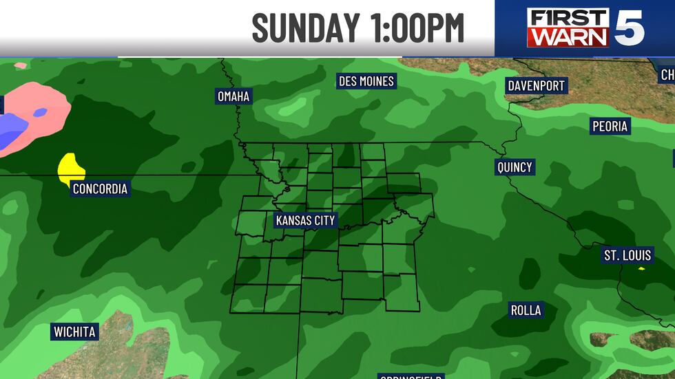
EASTER SUNDAY: Rain likely, and it may be heavy at times. Timing is currently morning and afternoon, with mid-late afternoon turning drier. Highs in the upper 60s and windy, with south gusts up to 40 mph.
Copyright 2025 KCTV. All rights reserved.


