FIRST WARN FORECAST: Storms may wake you up Thursday, updates on Easter weekend rain
We are First Warning you for scattered strong storms late tonight and into Thursday morning. Friday also sees a chance for storms that could again be strong, though they may just miss the metro. Both Saturday and Sunday are being First Warned for rain impacting plans, but new information is shedding light on which day is drier and which is wetter.
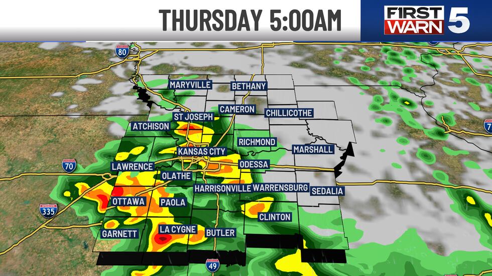
THURSDAY: FIRST WARN for scattered strong storms early in the morning, from 4 am to 8 am for Kansas City. A few spots could see hail and high winds with a Level 1/5 risk for severe weather. The metro will be dry by 9 am and stay dry the rest of the day. It will be warm and windy with highs in the low to mid 80s and south gusts up to 35 mph. A second round of strong storms is possible north of Kansas City late in the day, with a Level 2/5 risk for Cameron, Bethany, and Maryville.
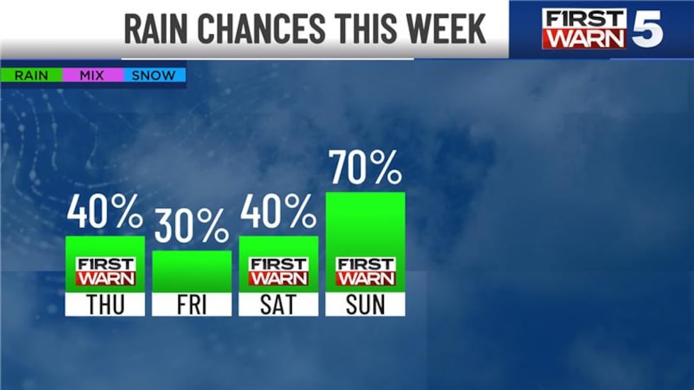
FRIDAY: Overall, a nice day in the metro with highs in the mid-70s. Strong storms are possible late in the day, where hail and high winds could occur in a few isolated spots. The most likely area to see these are east of Kansas City, though it’s close enough that there is a low chance in the metro.
SATURDAY: We are currently First Warning that rain could impact plans outside, but the odds of this happening are looking lower. The latest trend is much drier for the day. If this trend continues, we will drop the First Warn and call for a mostly dry Saturday. Cooler with highs in the upper 50s.
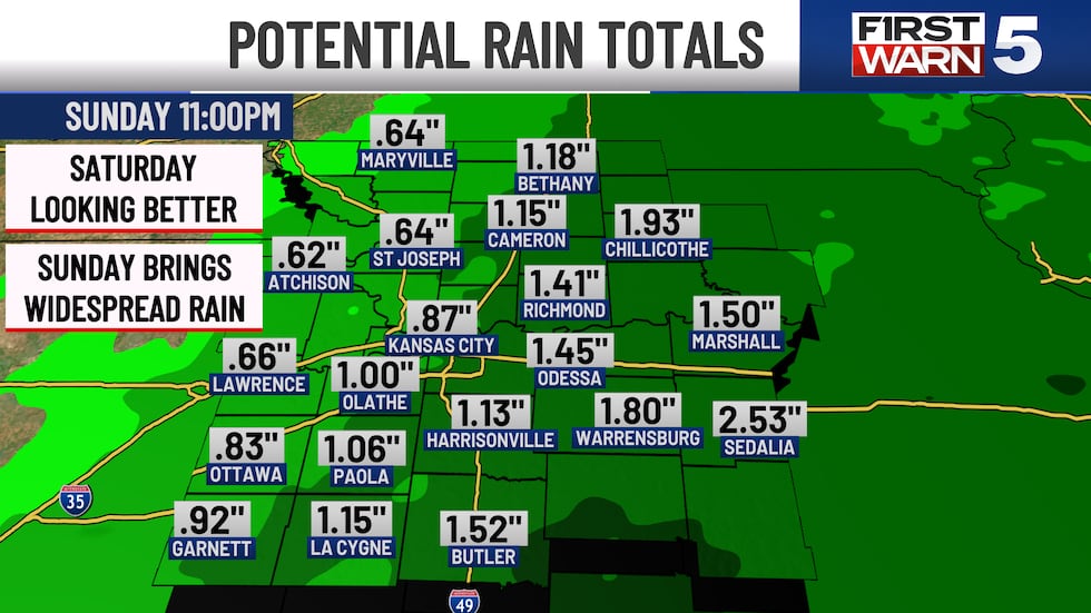
EASTER SUNDAY: FIRST WARN that rain is likely, and it could be much of the day. The best chance to catch some dry hours would be late in the day. Rain could be heavy, with 1-2″ possible in the metro. Cool and breezy with highs in the upper 50s and northwest winds at 15-25 mph.
Copyright 2025 KCTV. All rights reserved.


