Severe thunderstorm risk is over, flooding still an issue for some
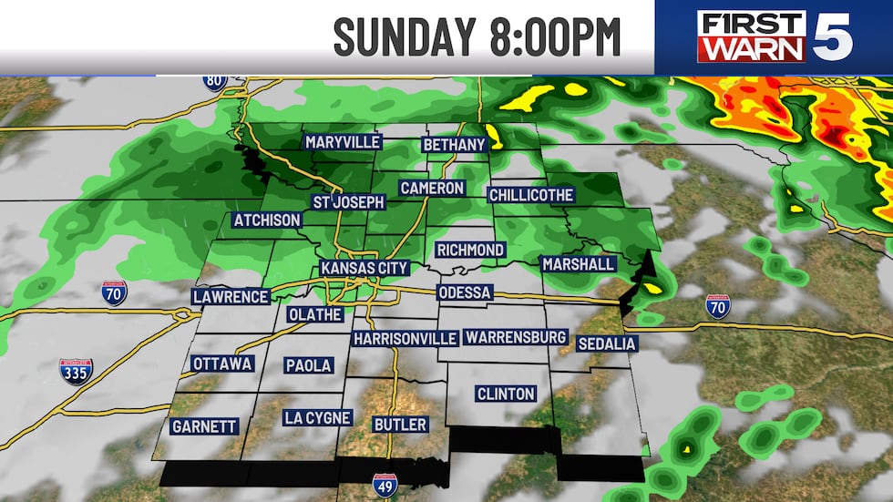
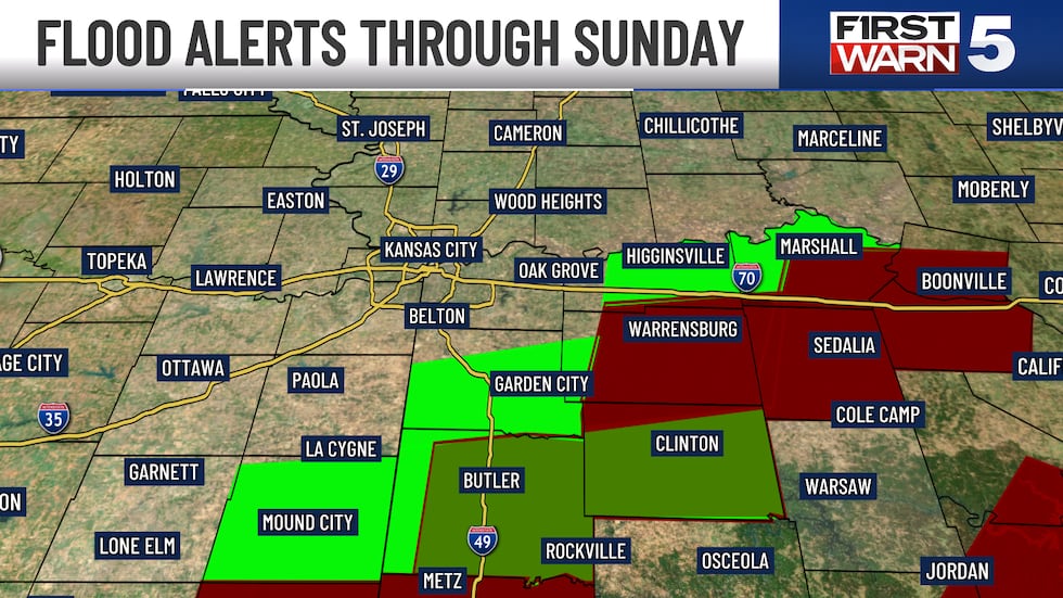
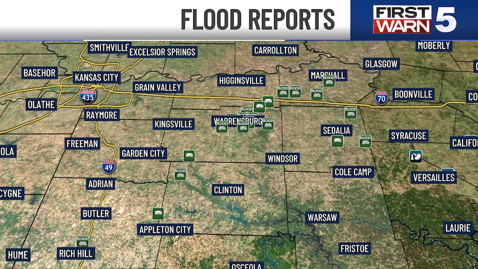
KANSAS CITY, Mo. (KCTV) - A few lingering showers are left, but an overall drying trend will kick in into the overnight. A flooding concern remains in place to the east/southeast of Kansas City where anywhere between 3 and 7 inches of rain fell in the last two days. Counties like Linn, Bates, Henry, Johnson MO, Pettis, Lafayette and Saline saw the highest totals. Water was over some roadways in these counties earlier Sunday evening, so watch for closed roads into Monday morning for that early commute. MCI officially picked up 0.98″ from Saturday and Sunday combined.
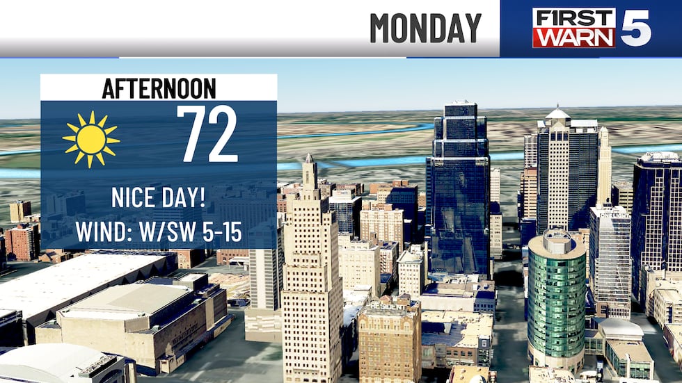
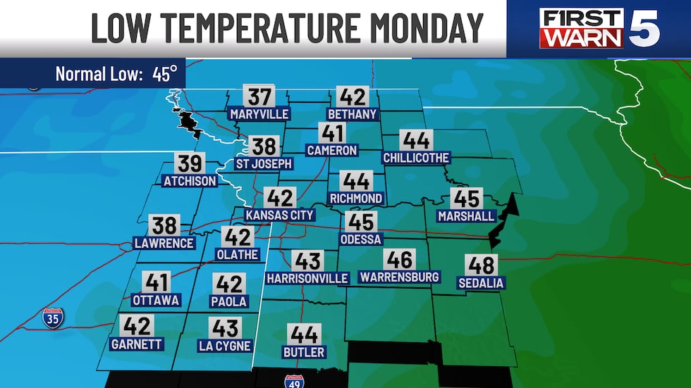
Clouds begin to clear overnight and we are expecting plenty of sunshine on Monday! Morning lows will be cool in the lower 40s, so you will want a heavier jacket out the door in the morning. By the afternoon, lower 70s are expected as a southwest wind takes back over. Enjoy it!
Most of our temperatures over the next week look springlike in the upper 60s and lower 70s. Tuesday is the exception with a slightly warmer afternoon in the upper 70s. Tuesday evening has a small chance for an isolated thunderstorm or two, but confidence is low at this time.
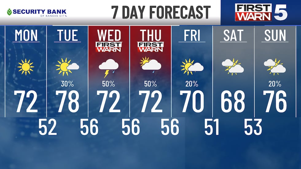
First Warns are in place for midweek as off and on rain and rumbles are looking increasingly likely. It won’t be a washout for all of Wednesday and Thursday, but there looks to be many different waves of rain that come through. At this point, no significant signals for strong thunderstorms, but we will watch that closely.
Copyright 2025 KCTV. All rights reserved.


