FORECAST: First Warns for storms this week, into the weekend
Late April and May are some of our stormiest times of the year, as this transition season before summer arrives tends to flare up the atmosphere. Such is the case tonight and through much of the forecast, with at least a chance for rain each day in the forecast. The days that stand out as the most likely to affect plans outside are Wednesday, Thursday, and Sunday. We have First Warns to spotlight each of those days.
THROUGH MORNING: We are in a Level 1/5 risk for severe weather, which means a storm or two could get strong enough to produce hail and gusty winds. We do not expect widespread strong storms, but just isolated patches of them.
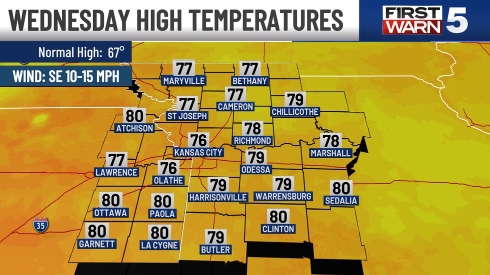
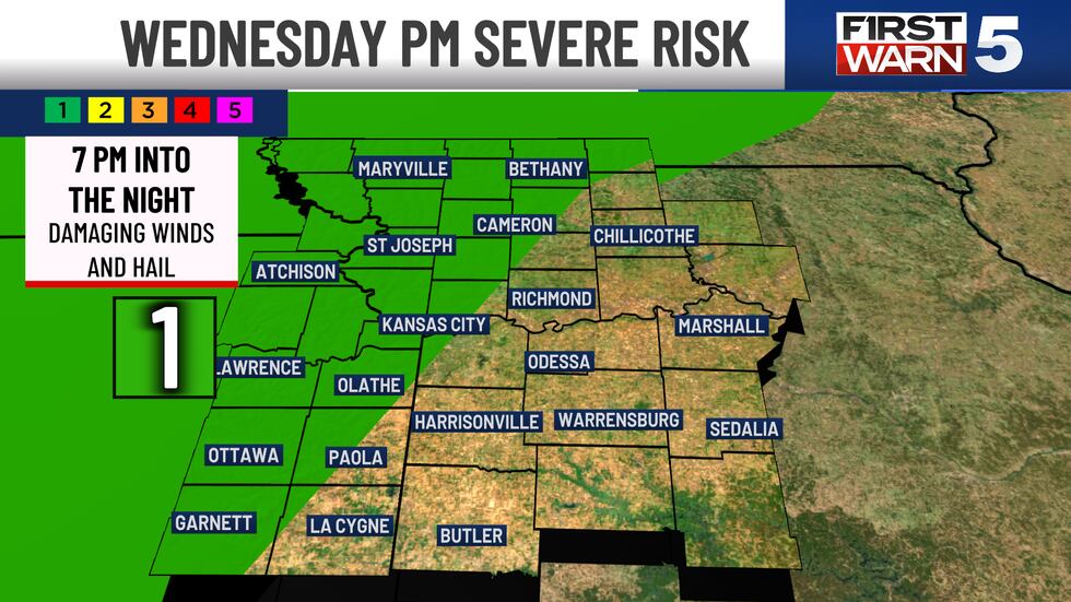
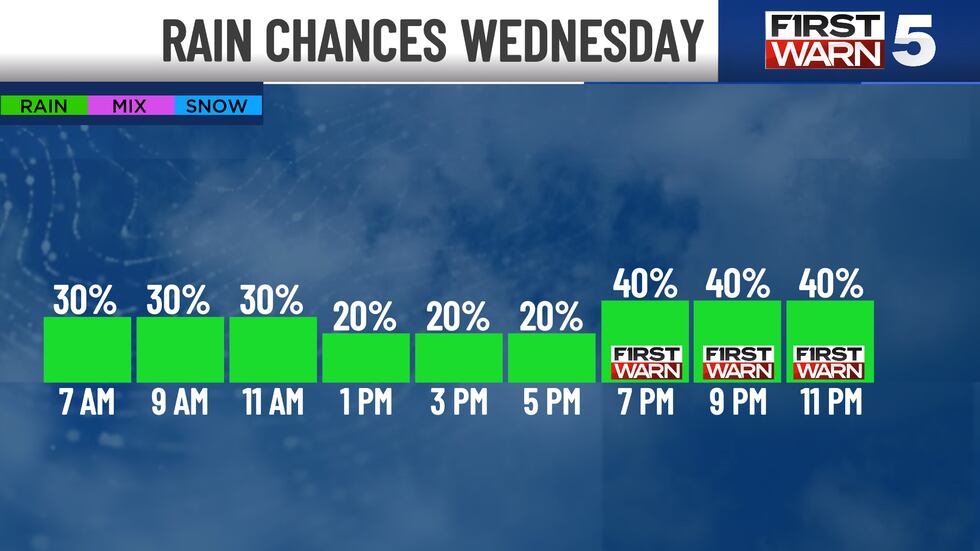
WEDNESDAY: First Warn for scattered evening storms, again a few could be strong. The morning may see some patchy rain, but these will be widely scattered. We’ll see mid-50s in the morning and mid-70s and generally dry for the afternoon. Winds will be from the southeast at 10-15 mph with mostly cloudy skies. Watch the sky from 7 pm and into the night, as another round of scattered storms enters the picture. Kansas City has a 40% chance to see them, so the scattered nature may cause them to miss your house. Still, there is a Level 1/5 risk once again for a severe storm or two.
THURSDAY: First Warn for scattered evening storms lasting into the night. Thursday will be mostly cloudy, with a generally dry morning. Highs hit the mid-70s with rain and storm chances increasing for the afternoon and evening. Kansas City has a 60% chance, making it the most likely day to see rain, and it could be heavy in spots.
FRIDAY: A few morning showers possible, then drier with mostly cloudy skies and highs near 70.
SATURDAY: Rain chances are low at just a slight 20%, making it the driest day in the forecast right now. Mostly cloudy with highs in the upper 60s.
SUNDAY: First Warn for scattered morning showers and thunderstorms, tapering off for the afternoon. Windy with south gusts to 30 mph and highs in the mid-70s.
Copyright 2025 KCTV. All rights reserved.


