FIRST WARN FORECAST: Rain possible at times over the weekend, but next week has our attention
A few of us may see non-severe storms overnight, but they will be widely scattered. We catch a break from rain for a bit, but we are First Warning for rain at times Sunday. By Monday, we are tracking the risk for severe weather. We have elevated it to our highest alert, a First Warn Weather Day.
FRIDAY: Some good news! The First Warn has been dropped, meaning the day is looking much drier than previous forecasts. The weather system we have been tracking will be through by sunrise, meaning the only chance for rain is up to about 8 am (and it is slim). The rest of the day will be dry, with mostly cloudy skies turning partly cloudy late-day. Morning temperatures will be in upper 50s, with the afternoon a bit cooler with upper 60s. Winds will be from the northeast at 5-10 mph.
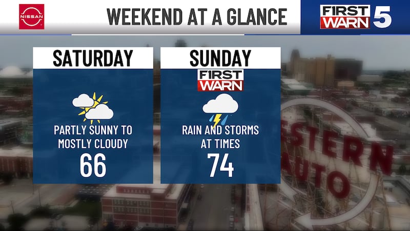
SATURDAY: The pic day for outdoor plans, as the rain chance is very slim at 20%. Mostly cloudy with highs in the mid-60s.
SUNDAY: FIRST WARN for scattered rain, primarily in the morning and up to lunch. It will not be rain all day long. Highs will be in the mid-70s with south winds gusting up to 30 mph.
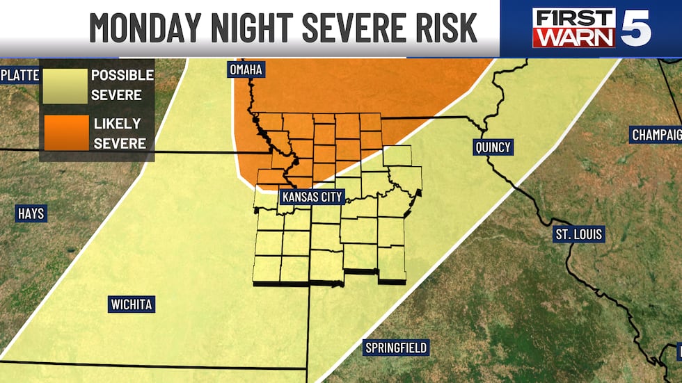
MONDAY: FIRST WARN WEATHER DAY as there is a rather high chance for severe storms. Current timing is late-day and into Monday night, but timing is far from locked in. Warm with highs in the low 80s, and humidity will be noticeably higher. Very wind with south gusts to 40 mph.
Copyright 2025 KCTV. All rights reserved.


