First Warn Forecast: Isolated to scattered showers expected throughout Sunday
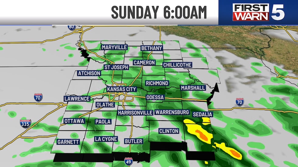
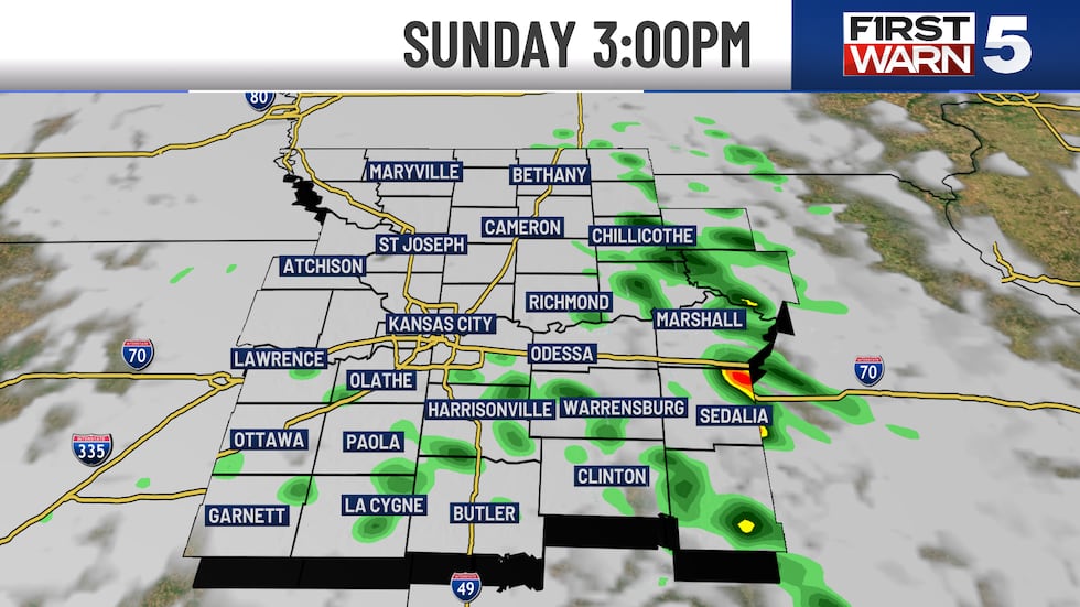
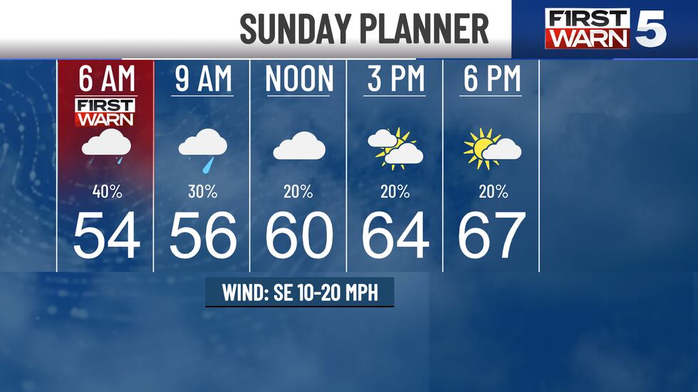
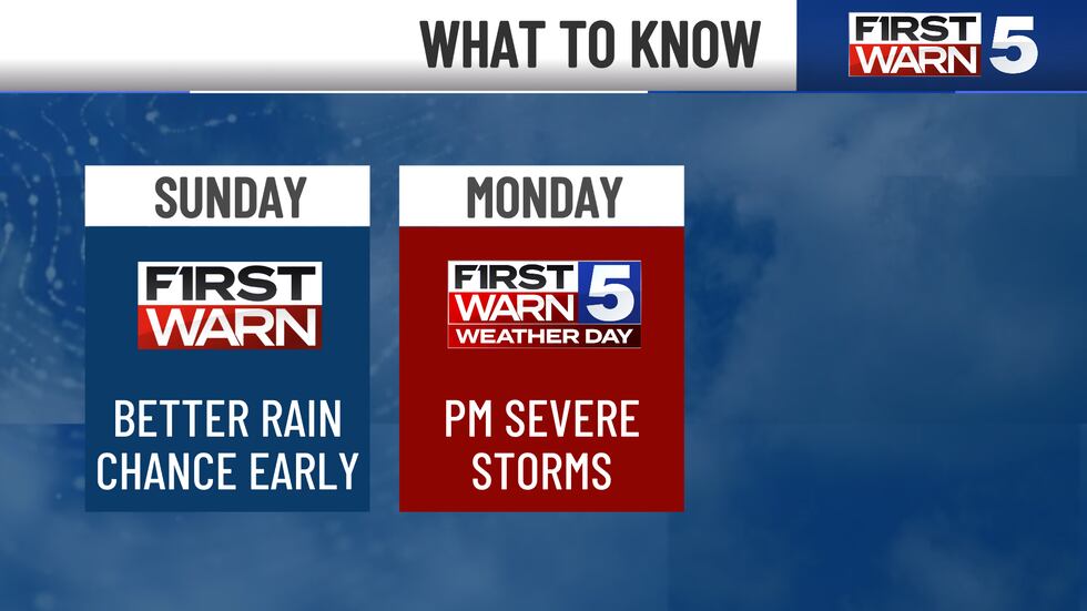
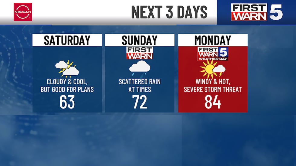
KANSAS CITY, Mo. (KCTV) - Off and on showers are expected through the overnight and Sunday morning. Sunday’s best rain opportunity is early in the day, but we can’t rule out an isolated shower or pocket of drizzle into midday. The air becomes fairly saturated with humidity levels increasing through the day. With a good deal of low cloud coverage, our temperatures only warm into the mid/upper 60s. The later you go in the day, the lower the rain chance. Those clouds try and break up a bit into the evening. Our First Warn in place on Sunday will mainly cover the early morning, then coverage turns much more isolated. Winds will be out of the southeast from 10-20 mph during the day. You will have plenty of dry time to get outdoors still on Sunday.

A First Warn Weather Day remains in place for Monday as our potential for severe thunderstorms continues to grow. The day looks mainly dry, with a stronger south wind pumping in some warmer and more humid air. Wind gusts on Monday are expected to reach the 35-40 mph range. High temperatures will reach the lower 80s. There will also be ample moisture in our air. All of these ingredients are going to help in the development of thunderstorms later in the day. Right now, it looks like a few thunderstorms could form in the afternoon. The coverage here will be much more spotty, but any storm that gets going in the afternoon/early evening has the potential to become strong, quick. This environment is favorable for a few supercells to form. The severe hazards with supercells are large hail, gusty winds and even tornadoes. This timeframe is where the higher tornado risk will be, if these storms develop. There is a little bit more of a question mark on if the storms can break through the CAP in the afternoon.
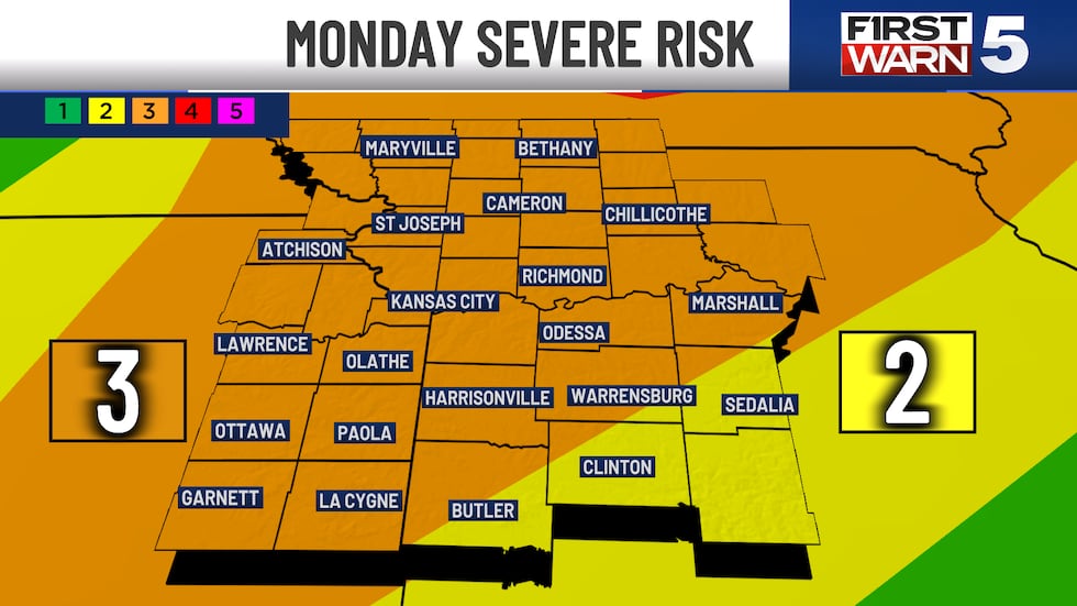
Later in the evening the cold front starts to kick in. Timing on this looks to be after sunset. With the front coming through, this would create more widespread rain and thunderstorms in a line. The tornado threat does not go to zero, but it does begin to drop a bit. Straight-line winds are the larger hazard along a line of storms. Depending how fast it moves through, we could have rain and storms into the early overnight before clearing out Tuesday morning. Please stay with us for the latest updates and shifts. We will continue to get you transparent updates. This is a good time to review your safety plans. Also, make sure you have multiple ways to receive weather warnings.
There will be some more off and on rain and thunderstorm chances later in the forecast. Wednesday and Thursday have a slightly higher confidence so we have a First Warn on them. No indications at this time for severe thunderstorms with mid/late week activity.
Copyright 2025 KCTV. All rights reserved.


