FIRST WARN FORECAST: Thursday trending drier but new First Warn for Friday storms
New information for Thursday is trending drier, so we have dropped the First Warn. While rain is still possible at times, it likely won’t have a big impact on your day. On the other hand, Friday’s rain chance has picked up, with a couple rounds of rain and storms possible.
TONIGHT: Scattered rain and a few rumbles of thunders possible, but severe weather is not expected. Low temperatures will fall to the upper 50s.
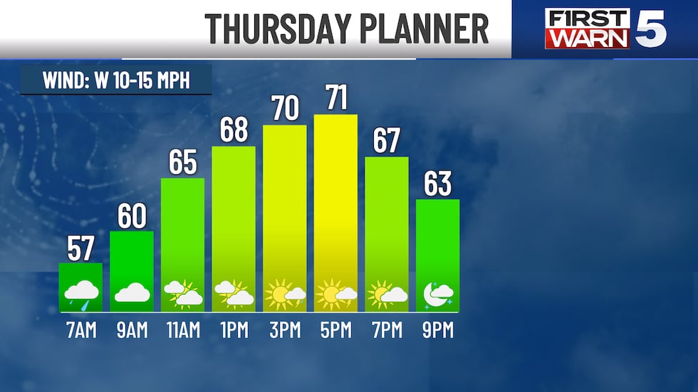
THURSDAY: An isolated bout of rain or brief thunderstorm possible. Rain chances 30%. The most likely time would be near sunrise, then again from 3 to 6 pm. Highs hit the low 70s with west winds at 10-15 mph.
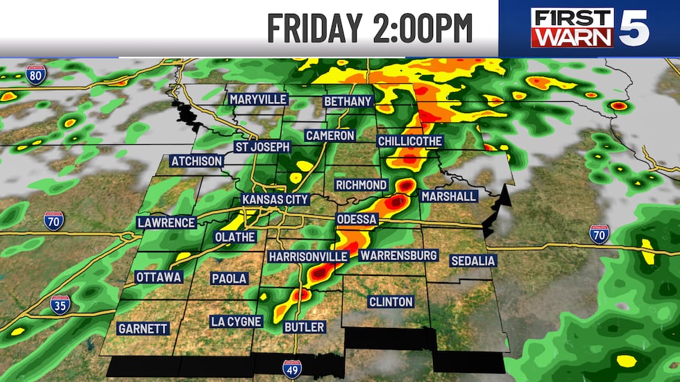
FRIDAY: FIRST WARN for scattered storms in the afternoon and evening. Rain chance is 50%. Highs will be in the upper 60s, but cooling off behind a front by mid-day.
SATURDAY: A stunning day! Highs near 70 with sunshine and light winds.
SUNDAY: Another wonderful spring day to be out and about in Kansas City with highs in the low 70s and sunshine.
NEXT WEEK: A bit of a warm-up with mid-70s and generally low rain chances.
Copyright 2025 KCTV. All rights reserved.


