FIRST WARN FORECAST: Pleasant spring weather for now, First Warn for rain by mid-week
Our weather pattern at the moment is hard to top. Cool mornings, mild spring afternoons, low humidity, and light winds are all working together for pleasant days to be outside. While Tuesday will remain rather nice, we are First Warning for a transition back to wet weather by Wednesday.
TUESDAY: Cool in the morning with temperatures near 50 at daybreak, but we warm rapidly to an afternoon high in the mid-70s. Light winds and low humidity continue. While the morning starts with sunshine, the afternoon will turn more cloudy. We remain dry through the day.
WEDNESDAY: FIRST WARN for scattered rain. The wettest part of the day is likely the morning, though spotty afternoon showers are still possible. No severe weather is expected. Morning lows will be in the mid-50s with the afternoon highs in the upper 60s. Rain totals near 0.25″ possible.
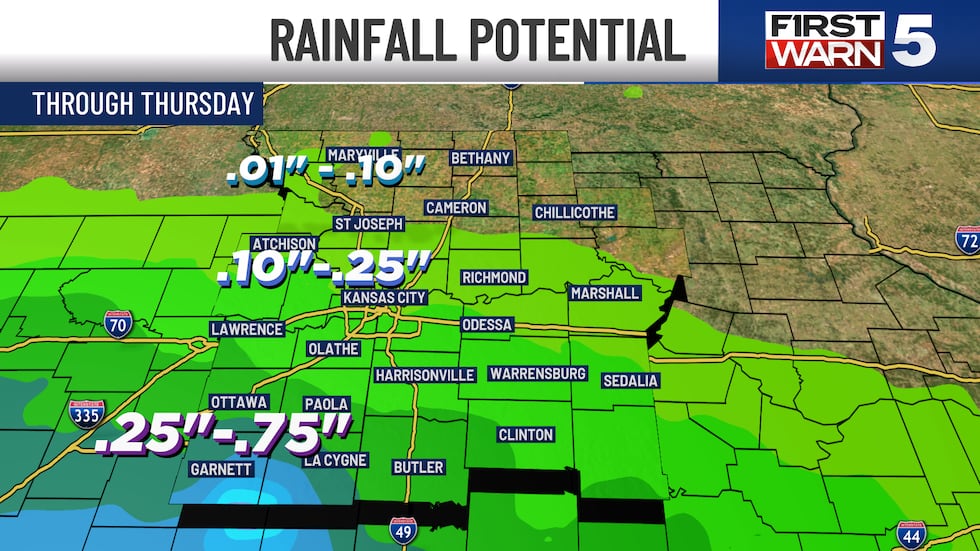
THURSDAY: Isolated rain still possible, but likely not enough to have a major impact on your day. The best rain chances will be south and west of the Kansas City metro. Morning lows in the mid-50s with an afternoon high near 70.
FRIDAY: A very pleasant end to the week with sunshine and highs in the mid-70s.

WEEKEND: Warm and wonderful. Sunshine all weekend long, with Saturday running to the upper 70s and Mother’s Day Sunday hitting the low 80s.
Copyright 2025 KCTV. All rights reserved.


