FIRST WARN FORECAST: Sensational Mother’s Day weekend then turns to a summer sizzle
Spectacular spring weather is locked on for Kansas City this weekend, with bight blue skies and warm afternoons. It will be wonderful to be outside either day. Looking ahead to next week, we see high temperatures on the rise. This will be the warmest stretch of weather we have had so far this year, and it will even match what’s average for the 4th of July at times. We also see some ingredients coming together for storms by late next week.
WEEKEND: Saturday starts a bit cool with upper 40s, but it won’t take long for the sunshine to boost us into the 80s. The afternoon high is forecast to hit 82 with clear blue skies and light northeast winds. Sunday is much the same, though the forecast is a bit warmer at 83. Both days feature low humidity. The UV index will be at a 9 both days, so sunscreen is wise.
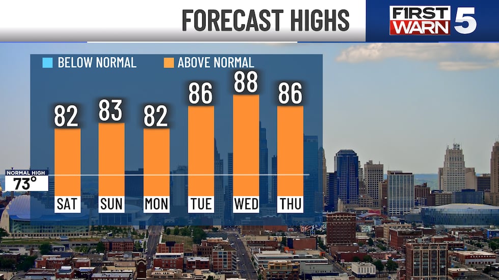
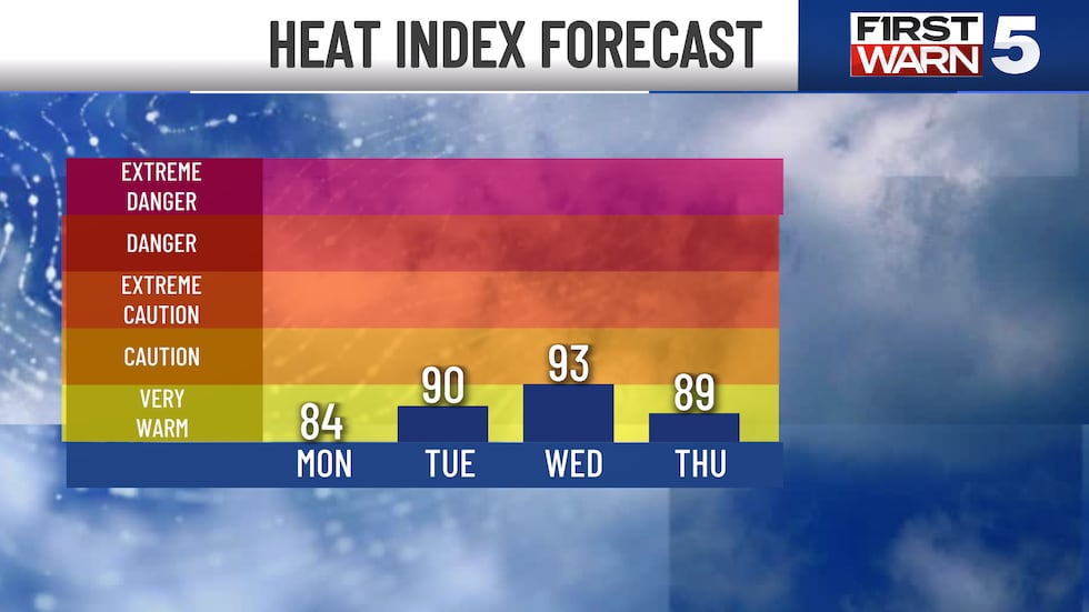
NEXT WEEK: Low 80s start the week, and there is a very slim 20% rain chance on Monday and Tuesday. Odds are the rain stays east of Kansas City. Wednesday turns hot with a forecast of 88, matching the normal for the 4th of July. Humidity will also be rising, so the heat index will likely be in the 90s. We do see storm potential by Thursday and Friday.
At the moment, only some of the ingredients are in place, so it is not a lock that they’ll happen. Just overall in the big picture, the atmosphere will be more capable of producing storms. If they do form, there would likely be at least some risk for severe weather. We’ll be watching it for you!
Copyright 2025 KCTV. All rights reserved.


