Prime spring weather for now, eye on next week’s storms
Monday has our attention, as it brings an increasing risk for severe weather. New today, we have elevated it to a First Warn Weather Day (which is our top alert). Storms could begin as early as Sunday night, and they may come in multiple rounds through Monday night. Details remain unclear, but the big picture is it is a day to keep an eye on. At this point, just remain informed and be checking in with us. We will be keeping you prepared the whole way through with several updates each and every day.
Before the storms roll in, we have lots of very pleasant weather to enjoy into the weekend.
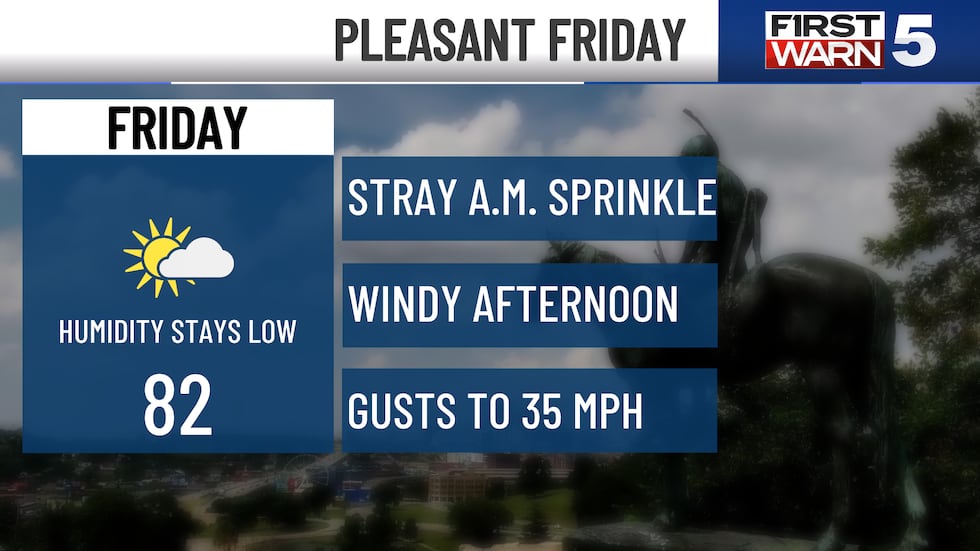
FRIDAY: Cool and pleasant for the morning, with temperatures starting out in the upper 50s. A stray morning shower is possible, though the better chance in north of the metro. The afternoon is warm and a bit windy, with highs in the low 80s and northwest breezes gusting up to 35 mph. Skies will be partly cloudy.
THE WEEKEND: Saturday is the pick weekend day to be outside, but both will generally be nice during the daylight hours. Saturday brings upper 70s, low humidity, light winds, and partly cloudy skies. Sunday has a slim rain chance in the morning, though most of the day will be dry. It will be warmer and more humid with low 80s. Scattered storms are possible Sunday evening and Sunday night.
MONDAY: FIRST WARN WEATHER DAY - Severe storms are possible. The chance for rain and storms is 60% for the Kansas City area, and heavy rain may occur in some areas. It won’t rain all day, but likely comes in bouts. Highs will be in the low 80s.
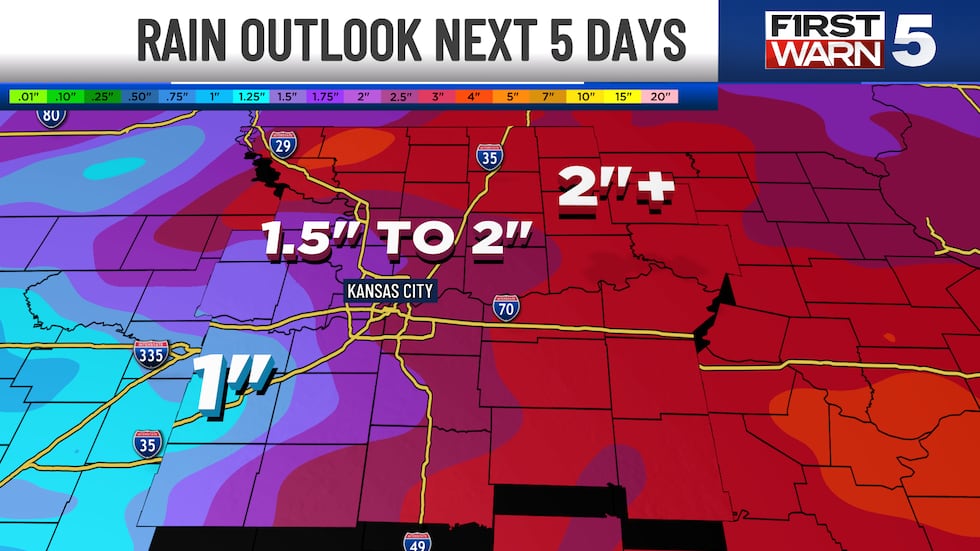
TUESDAY: The severe weather threat appears to move east, but widespread rain looks increasingly likely. Highs will be in the mid-70s.
WEDNESDAY: Trending drier and much cooler with highs in the upper 60s and stiff northwest winds up to 35 mph.
Copyright 2025 KCTV. All rights reserved.


