First Warn Forecast: Some thunderstorms Sunday night, larger severe threat Monday
KANSAS CITY, Mo. (KCTV) - After a quiet and beautiful weekend, our focus turns to multiple thunderstorm chances from now through early Tuesday morning.
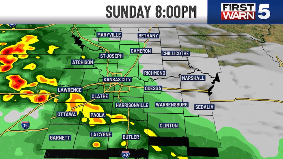
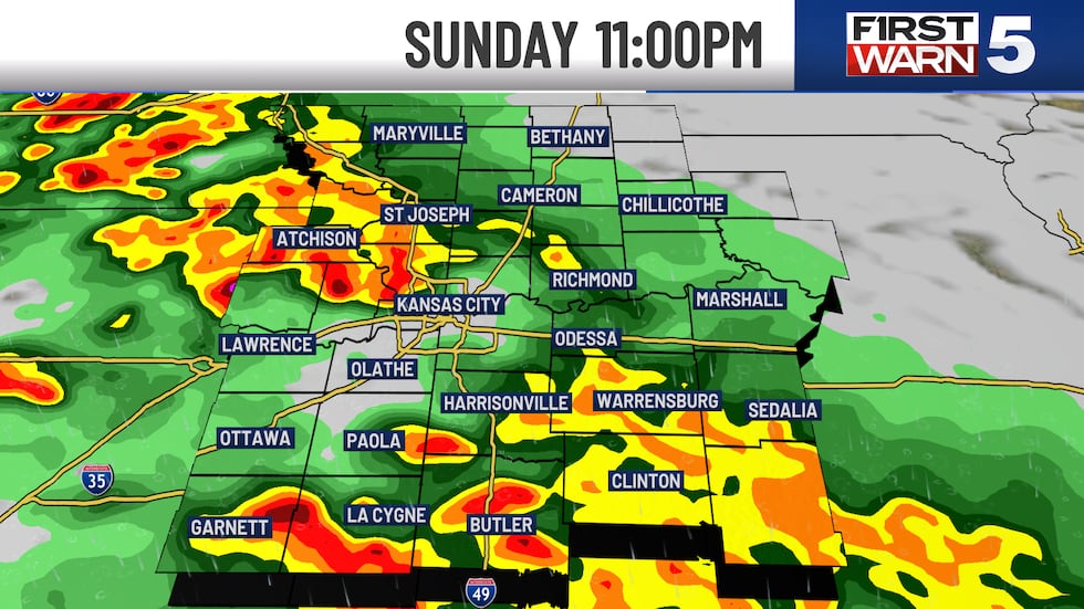
Sunday Evening:
Storms are struggling to maintain out there into Sunday night, but a few pockets of heavy rain and rumbles will continue. Our risk for severe thunderstorms is pretty low at this point. Best case scenario, we just get a few noisy thunderstorms with some much-needed rain and no severe storms. I think that from Sunday night’s rain, we could pick up a quarter to three-quarters of an inch, depending on where some of the heavier downpours set up.
To watch First Warn 5 Radar, click here.
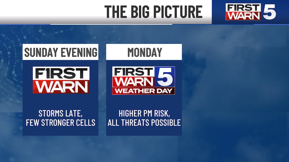
Monday:
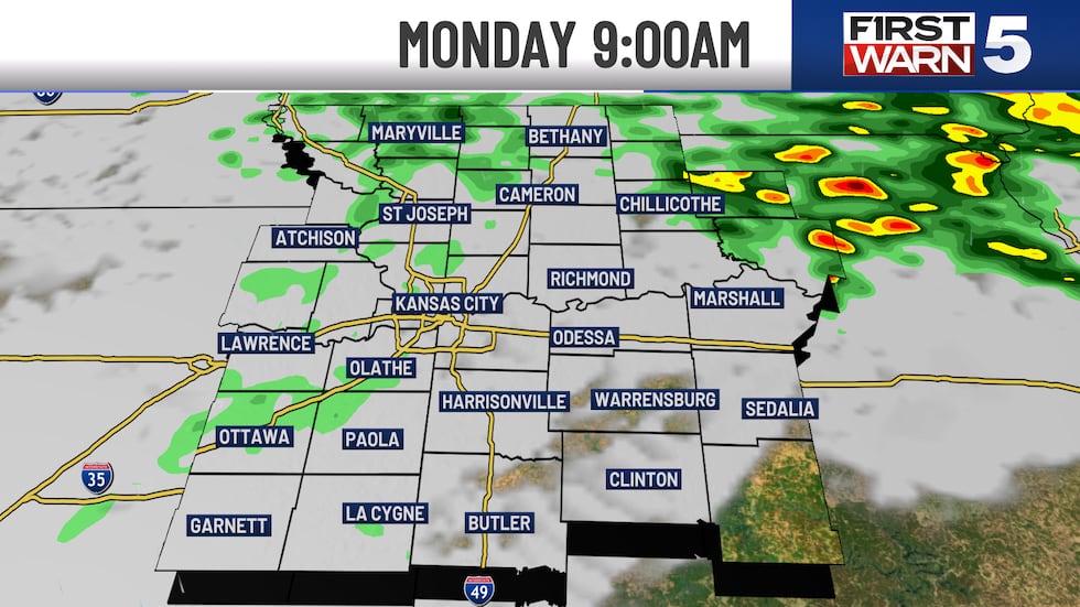
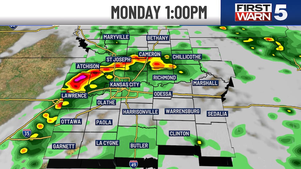
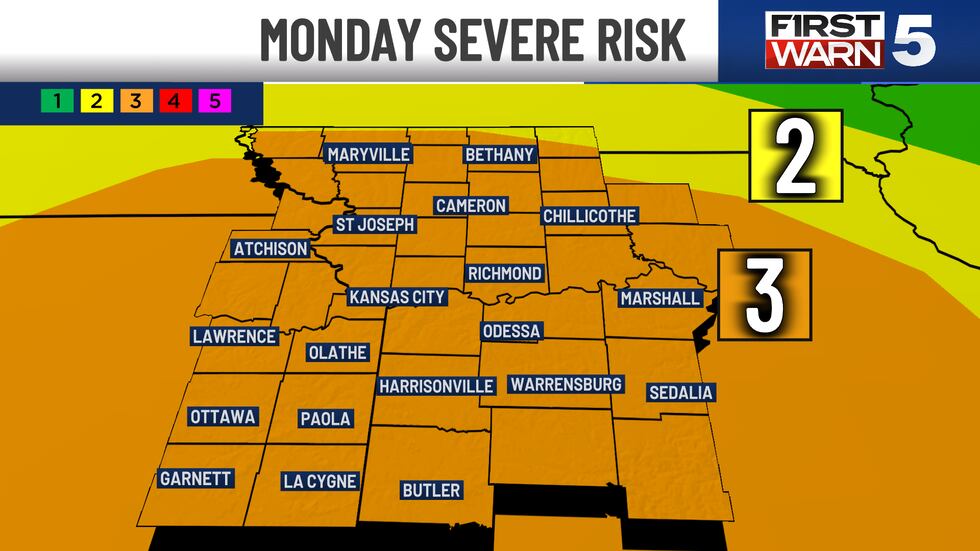
Let me start by saying that Monday’s rain and storm opportunity is not overly cut and dry. We do have a heightened risk for severe thunderstorms on Monday, prompting the First Warn Weather Day, as all of the KCTV coverage area is in a Level 3/5 risk. The morning appears to be rather dry, but a few random showers will be possible the closer we get to lunch.
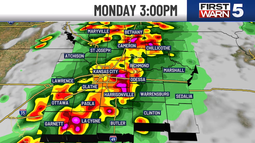
As that warm front finally lifts through, a couple of thunderstorms could pop up as early as lunchtime. There will be a chance for a few stronger cells on that warm front. Now that we are in the warmer and more humid air mass on Monday afternoon, it appears we could fire up multiple different batches as a dry line comes in from the west. If a few supercells can fire up in the afternoon, there will be a risk for large hail and even a tornado or two.
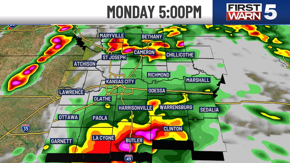
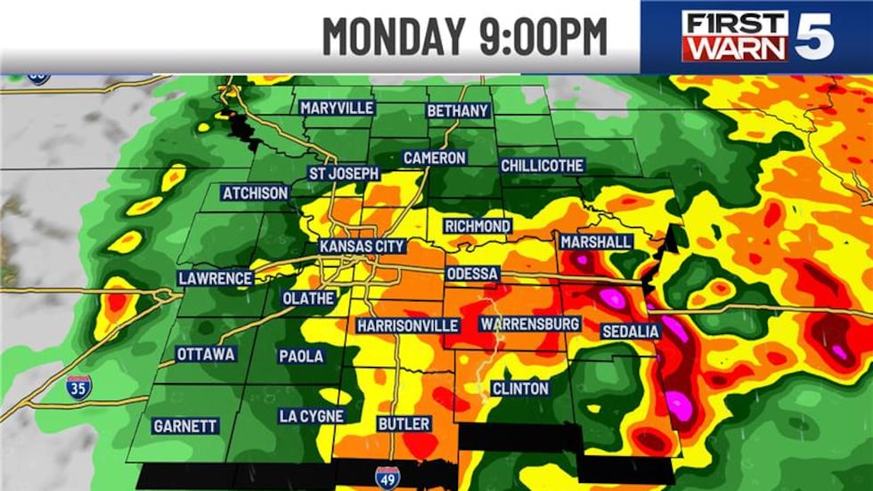
The later we go into Monday evening, a final line of thunderstorms will form to the west on an approaching cold front. As this pushes through probably after 7 PM, there will be more of a wind threat and hail, with a lower tornado risk. Throughout multiple different batches of scattered storm chances on Monday, we could pick up another one to two inches of rain in locations that see heavier storms. Leaving your entire storm total in the 0.75″ to 3″+ range. We have a big rainfall deficit for May so far, so the rain is needed. Most of our thunderstorm activity should be done by early morning on Tuesday as that front finally pushes through. Hopefully all of this is out by the morning commute.
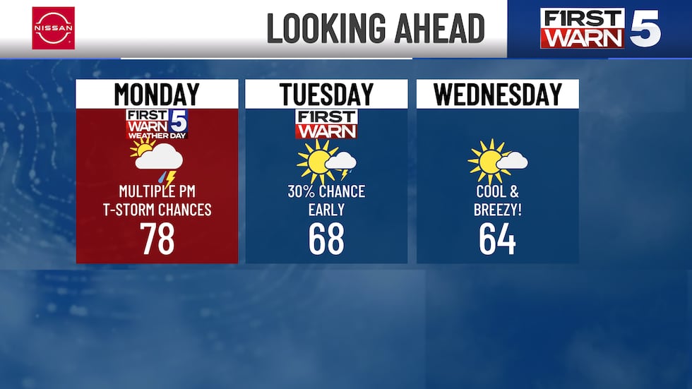

Wednesday and beyond:
We have much cooler temperatures for the middle of next week. We are thinking highs will be below normal in the 60s from Tuesday through Thursday. It looks pretty breezy out of the northwest as well. As winds turn back out of the south later this next week, temperatures warm back into the 70s. However, we are seeing signals for a few off and on showers Friday and Saturday. Nothing overly impactful at this time.
Copyright 2025 KCTV. All rights reserved.


