FIRST WARN FORECAST: Unusually cool for now, rain returns for the weekend
The storms are gone, and in their wake is unusually cool weather. We have temperatures more common for mid-October than the back half of May. While there are a few low shots for rain this week, the weekend brings our next round of widespread and likely heavy rain. We are specifically First Warning you that Saturday could be quite wet at times, but the severe weather threat is currently low.
WEDNESDAY: Cool morning with upper 40s and sunshine. The afternoon high of 68 is well below the normal high of 76. We will see increasing clouds late in the day with northwest winds at 10-15 mph. Isolated showers or a stray thunderstorm possible from 4 - 11 pm. The chance for rain in Kansas City is 30%.
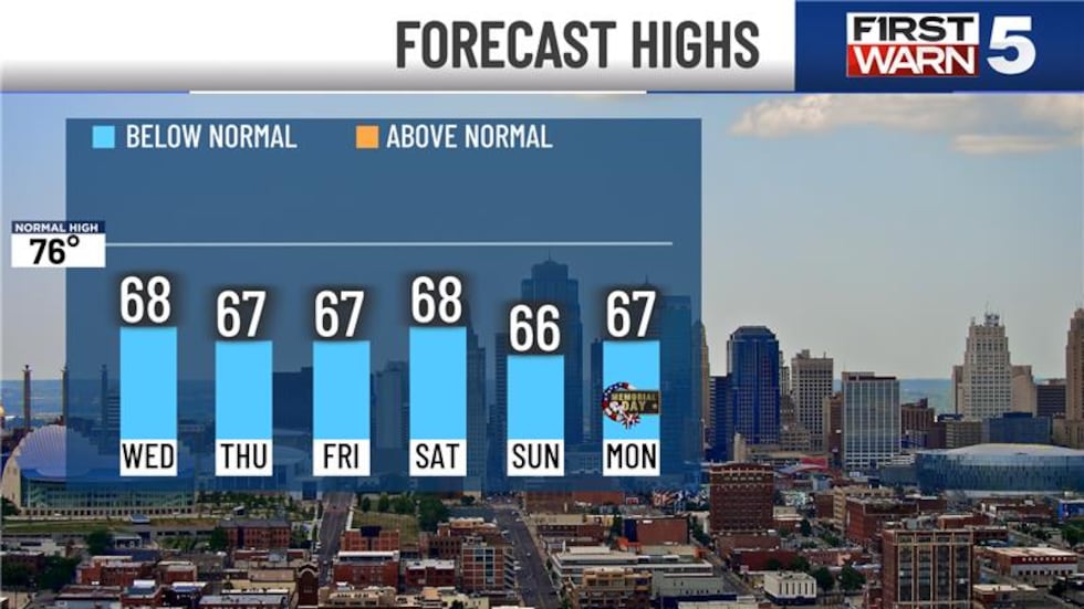
THURSDAY: Dry and cool with morning lows in the upper 40s, afternoon highs in the upper 60s, and northwest winds at 10-15 mph.
FRIDAY: More upper 40s in the morning with upper 60s in the afternoon. Mostly cloudy with a 30% chance for rain in the afternoon and evening.
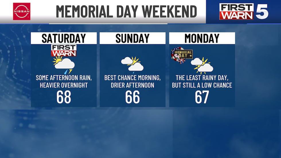
MEMORIAL DAY WEEKEND: FIRST WARN FOR RAIN SATURDAY - Saturday has a likely chance for rain in the afternoon and into the night. The day will not be a washout, as the morning looks dry at the moment. The heaviest rain looks to come in Saturday night through early Sunday morning. Sunday will be drier for the afternoon. Memorial Day Monday still has a low chance for rain, but it looks light at very isolated at this point. We may see rather heavy rain at times over the weekend, especially Saturday night, with rain totals of 1-2″ currently forecast (that’s on top of the 2-4″ many of us just received). Highs will be in the upper 60s all weekend with lows in the 50s.
Copyright 2025 KCTV. All rights reserved.


