FIRST WARN FORECAST: New First Warns added for weekend rain
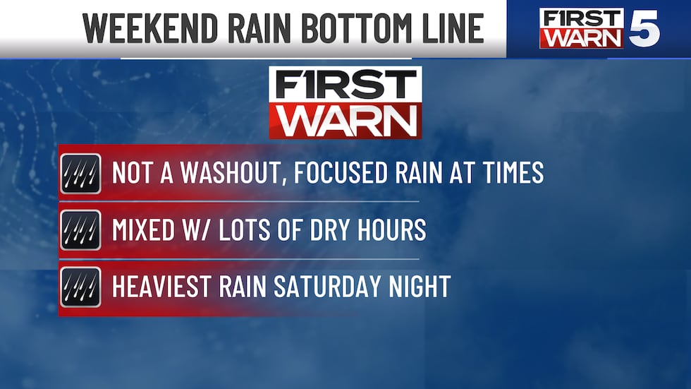
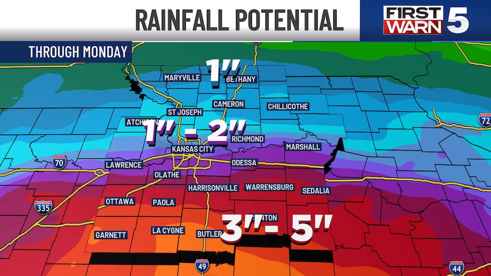
New information has come in that points to enough rain Friday, Saturday, and Sunday to have an impact on plans outside. Because of this, all three of those days now have First Warns to highlight this likelihood. It is also not a washout, as the rain will be focused at a specific time, and it will mix in with lots of dry hours. We will also see unusually cool weather for Memorial Day Weekend.
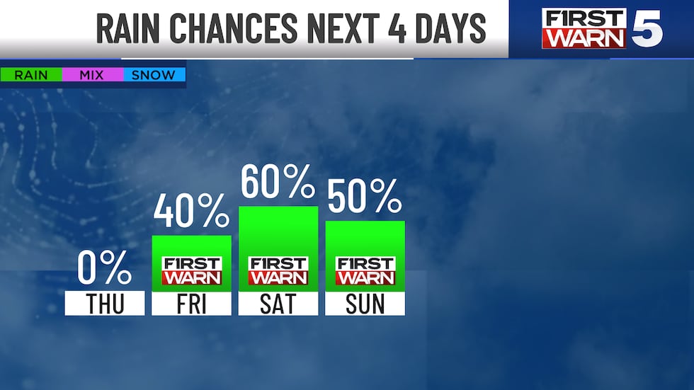
THURSDAY: A beautiful day! Another cool morning with upper 40s, but bright blue skies help warm the afternoon to the upper 60s. This is still well cooler than normal for this time of year, and it is more typical of October than late May. Winds will be from the northwest at 10-15 mph.
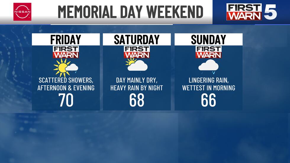
FRIDAY: FIRST WARN for scattered rain and spotty thunderstorms in the afternoon and evening. The rain chance is 40%, and there will be a dry time mixed with scattered showers. Highs will be near 70.
SATURDAY: FIRST WARN for widespread and heavy rain Saturday evening and Saturday night. The day will be largely dry with highs in the upper 60s.
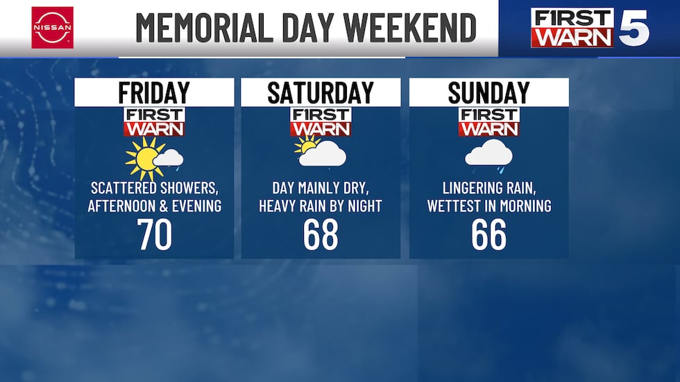
SUNDAY: FIRST WARN for morning rain, which will trend drier for the afternoon. Highs will be in the mid-60s.
MEMORIAL DAY MONDAY: Off and on rain still possible in the morning, though it currently looks more spotty than the rest of the weekend. It will be about 15 degrees cooler than normal, with near-record cool afternoon highs in the mid-60s.
Copyright 2025 KCTV. All rights reserved.


