FIRST WARN FORECAST: Cooler weather, rain chances fill Memorial Day weekend
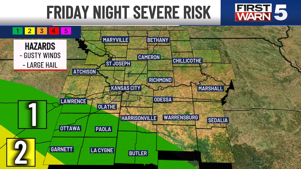
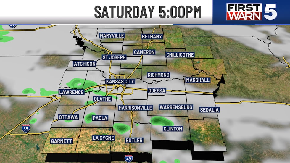
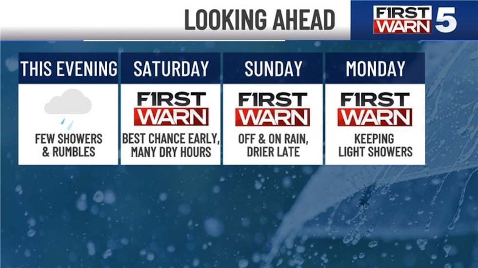
Radar will continue to fill in a bit overnight. Bringing more spotty rain with a few thunderstorms. Those of you near and south of I-70 will have the best chance, especially to the southwest of Kansas City. There is a small level 1/5 chance for an isolated strong to severe storm across Anderson, Franklin, Linn and Miami counties. The farther north you live from I-70, the less likely you are to get much from this batch.
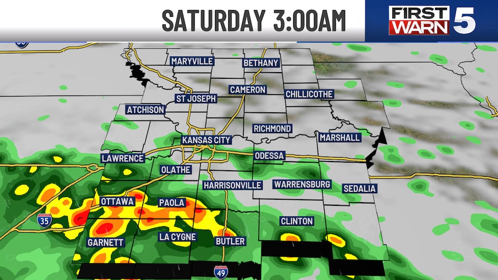
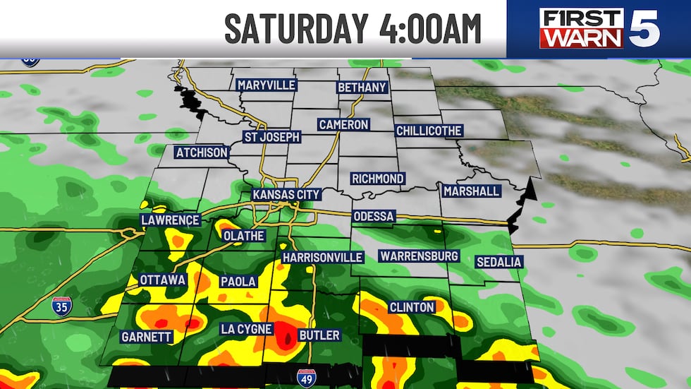
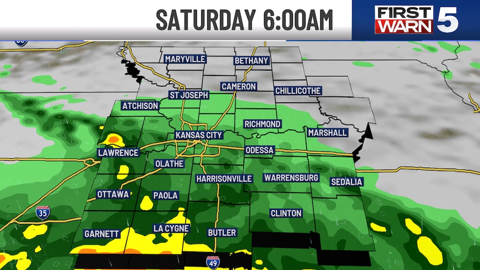
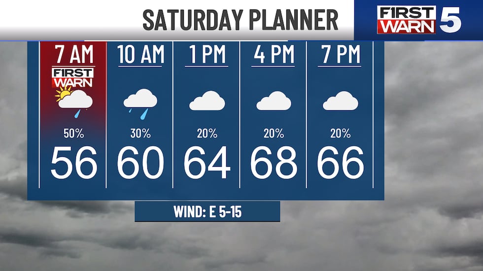
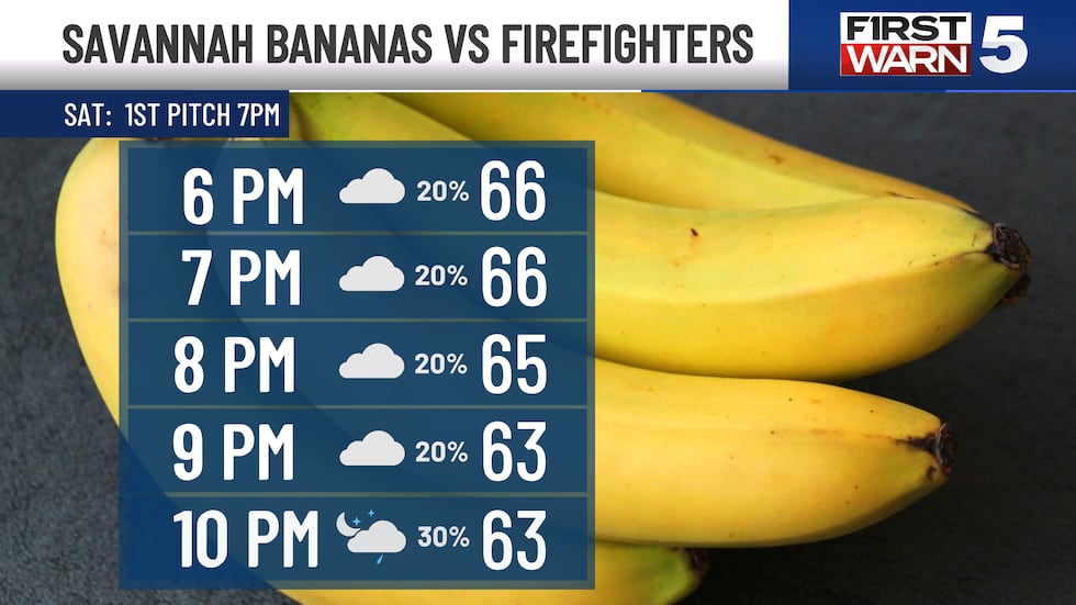
SATURDAY: Rain and thunderstorms look increasingly likely for those near and south of I-70 early Saturday morning, prompting a First Warn. Our latest computer guidance assumes most of it will be out of here by 8-10 AM, if not sooner. If you have outdoor plans, try and postpone them until midday or Saturday afternoon. After mid-morning, our rain chances are looking to fall off. While we could see a random sprinkle or light shower in the afternoon, most of the heavy stuff should be done early in the morning. Temperatures will make it to the upper 60s, under a mainly cloudy sky. Any Saturday evening plans also look okay. We might see something random/spotty, but no widespread heavy rain is expected at this time. Sporting KC and Savannah Bananas games look good.
SUNDAY: The first half of Sunday looks wet. Batches of off and on rain are expected, with a few embedded heavy downpours. This is the reason for the First Warn also on Sunday. I think a good chunk of our measurable rain will come from midnight through noon on Sunday. There are trends as of now to start to dry out in the afternoon again on Sunday, so hopefully those trends will hold so you can get outdoors! None of the next three days will be washouts. Highs are quite a bit cooler on Sunday in the lower 60s.
MONDAY: We added a new First Warn on Monday as one of our longer range computer models is hinting at keeping rain showers around for a good chunk of the day. However, we have some computers suggesting it will be a bit more dry. That is why at this point we have a 40% confidence and nothing more. The high temperatures will barely break into the lower 60s. This could be the coolest Memorial Day holiday since 1997, when the high temperature was also 61 degrees.
TUESDAY AND BEYOND: At this time, it looks like our rain chances will finally drop off Tuesday and Wednesday. High temperatures will only be in the upper 60s and lower 70s. Then, more spotty rain is possible on Thursday. Those of you searching for a summer feel will have to wait a bit. We might get back to our seasonal normal by next Friday, which would be mid 70ss.
Copyright 2025 KCTV. All rights reserved.