Dry for now, next batch of rain Saturday night and Sunday morning
KANSAS CITY, Mo. (KCTV) - We promised the weekend would not be a washout by any means, and Saturday turned out to be a great day!
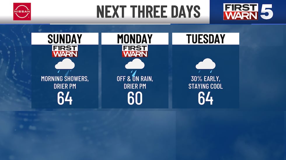
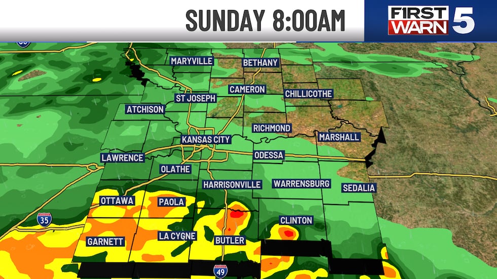

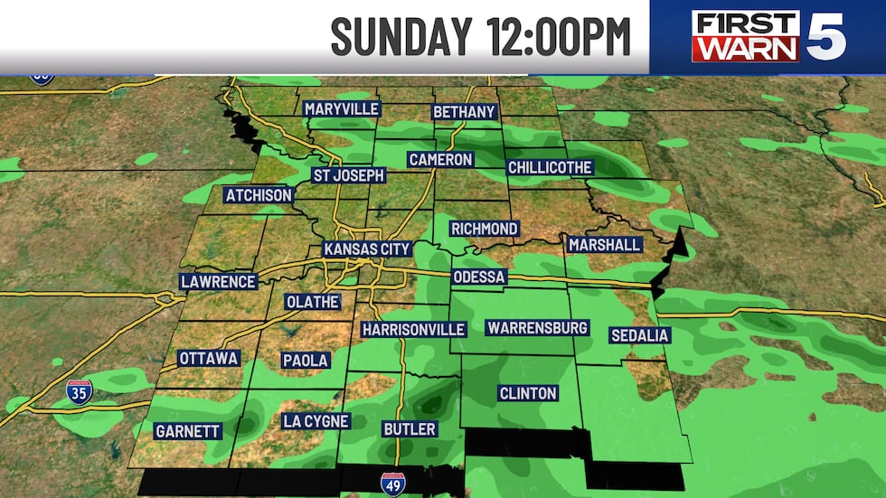
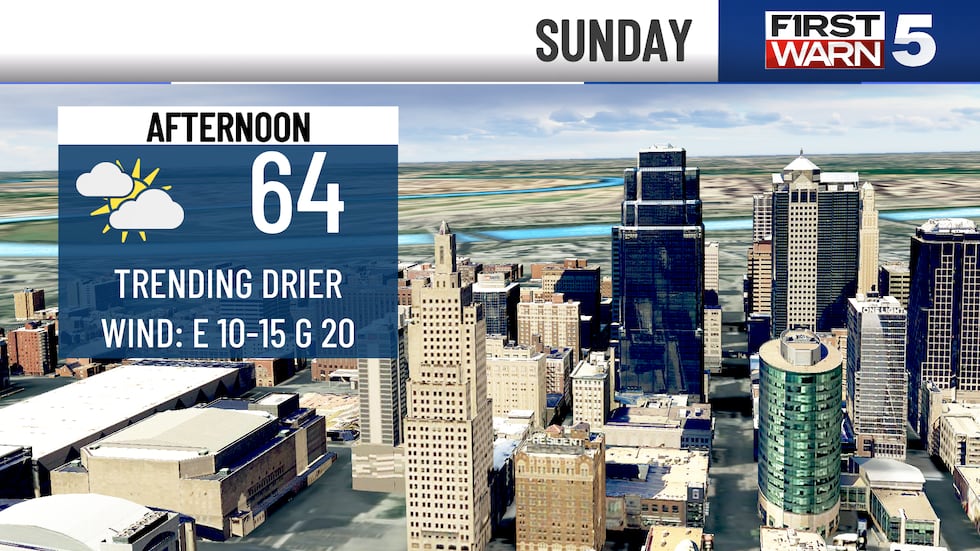
After midnight our radar will start to fill in a bit from the south. Our next system approaches from the west. Right now, Sunday looks to bring a pretty damp start, especially early in the morning. The better chance for steadier and more widespread rain will fall between about 5 AM and n 11 AM, so we have a First Warn in that time frame. Those of your south of I-70 will by far get the heavier rain. Maybe even a few embedded thunderstorms. The KC metro should get some light to moderate rain for a bit, but we probably won’t get more than a quarter of an inch when this next batch is all said and done. There will be plenty of dry time on Sunday as well. We might have a lingering shower through lunch, but the afternoon is trending much drier. Hopefully we can get a few more peeks of sun as well. So, I would try and focus your outdoor plans later in the day! Highs will only be in mid 60s, so cool but comfortable.
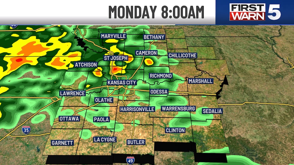
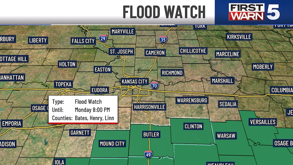
Monday is very inconsistent with the current data we have. We are beefing up the rain chance a bit, especially in the morning. When that batch moves out is a bit more unclear. The Royals are back in town for a Monday afternoon game, so hopefully rain can clear in time for that. Those high temperatures will be even cooler. We might barely get to 60 degrees. Keep in mind, our normal high temperature this time of year is 76 degrees. This system finally moves out and we can shake this wet pattern by Tuesday midday. A few leftover showers possible in the morning. Wednesday looks dry as of now, with a 30% chance for showers Thursday. The 70s are back in the forecast Wednesday and beyond.
Copyright 2025 KCTV. All rights reserved.


