FIRST WARN FORECAST: More showers this week, slowly beginning to feel like late-May
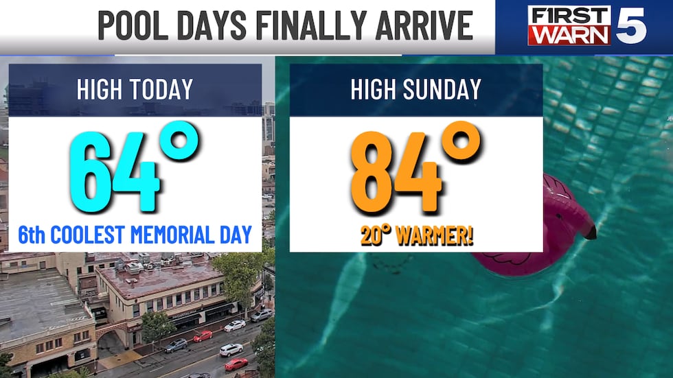
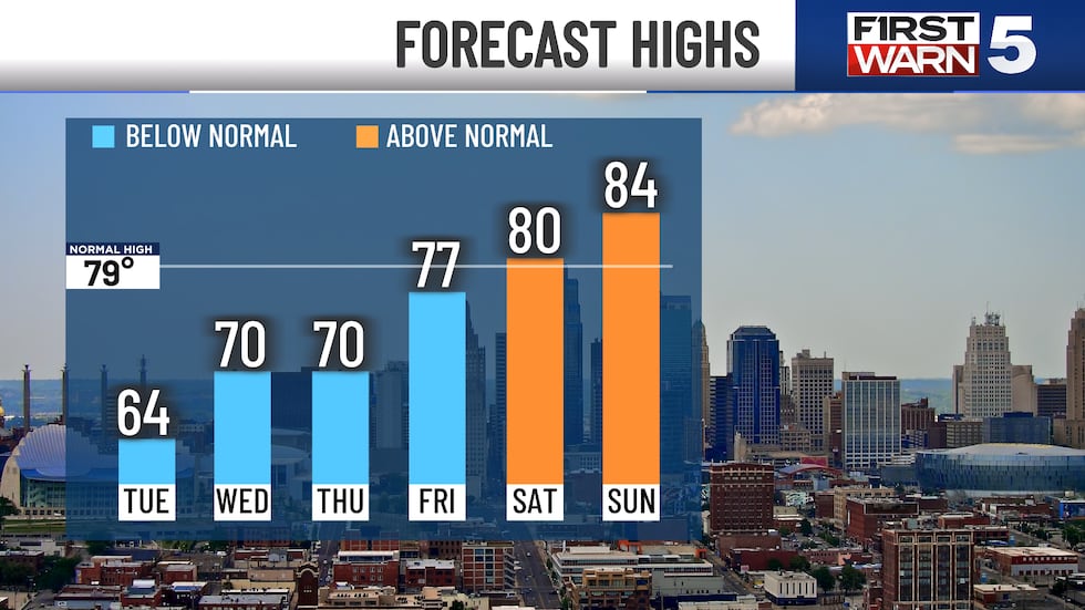
KANSAS CITY, Mo. (KCTV) - The two main headlines recently have been the wet weather and the abnormally cool temperatures. In fact, Memorial Day’s high of 64 tied for the 6th coolest on record in Kansas City. We do have more rain chances this week, but it currently looks to be more brief and scattered than what we have seen recently. We also slowly bring the heat back up, but it will be a slow process.
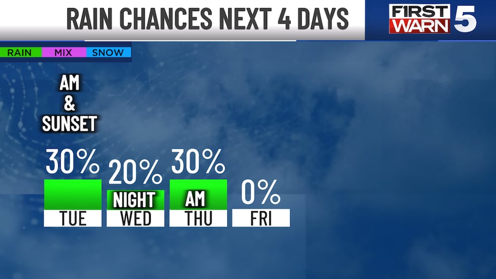
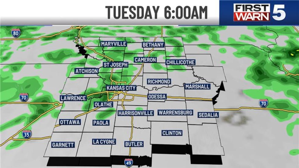
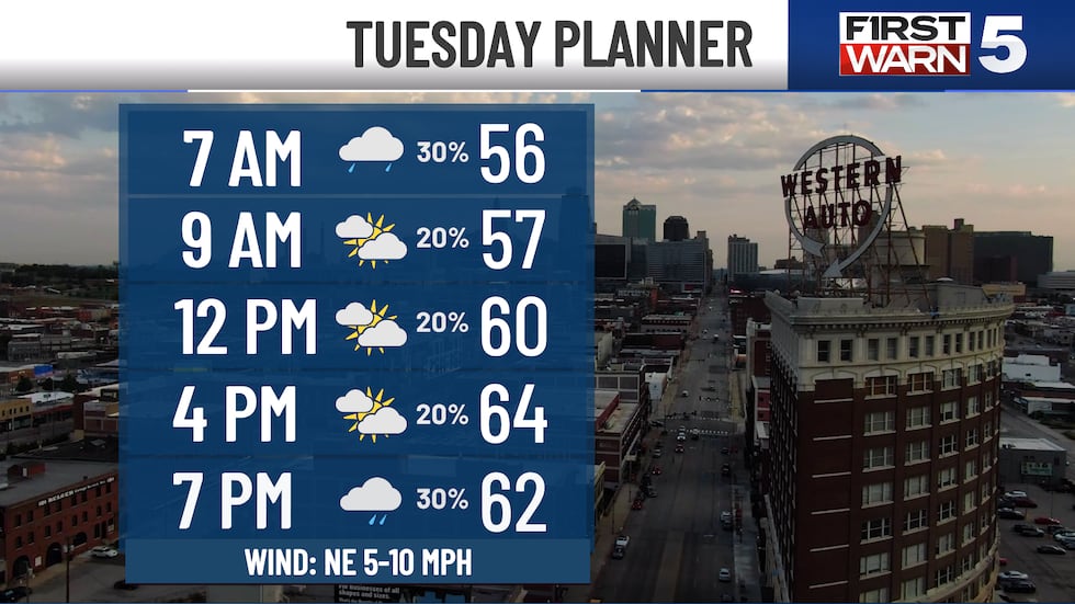
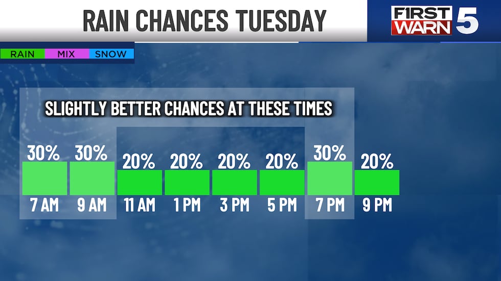
TUESDAY: Scattered morning rain through about 10 am, then mostly cloudy for much of the day with only slight rain chances. Temperatures start in the low 50s with highs in the mid-60s for the afternoon. Another brief round of scattered rain is possible from 7 to 10 pm.
WEDNESDAY: Slightly warmer with highs near 70 and partly cloudy skies. Isolated showers are possible in the evening and on Wednesday night.
THURSDAY: Scattered rain possible in the morning, with only slight rain chances for the rest of the day. Partly cloudy with highs near 70.
FRIDAY: Sunny and warmer with highs in the upper 70s.
THE WEEKEND: Warmer highs in the low to mid-80s. Saturday may see scattered storms in the afternoon and evening. The current chance for Kansas City is 30%.
Copyright 2025 KCTV. All rights reserved.


