FIRST WARN FORECAST: First Warn for rainy start to Thursday
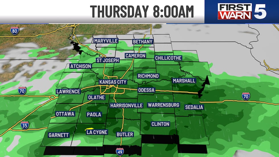
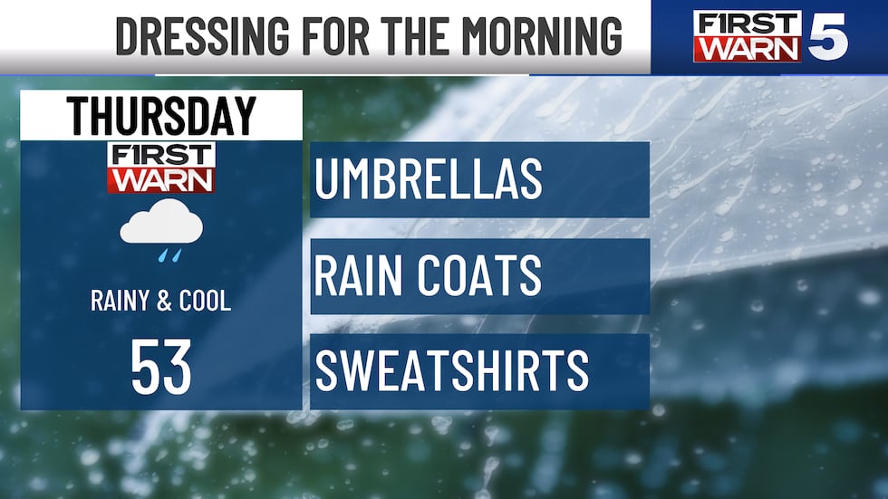
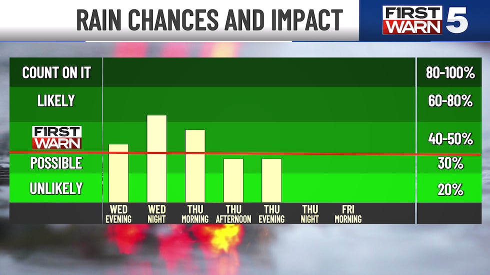
KANSAS CITY, Mo. (KCTV) - Widespread rain moves through overnight and Thursday morning, and we are First Warning that it will be widespread and persistent enough to have an effect on how your Thursday starts. Wet streets may cause minor delays on the morning drive, and outdoor activities are likely to be delayed.
TONIGHT: FIRST WARN - Widespread rain fills in overnight with temperatures falling into the 50s.
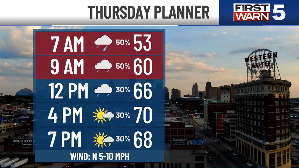
THURSDAY: FIRST WARN - Rain likely in the morning with temperatures in the low 50s, then trending drier after 10 am. The afternoon will see more sunshine and highs near 70 with light north winds at 5-10 mph. There is still a chance for spotty brief downpours in the afternoon and evening, but there will just be fewer of them.
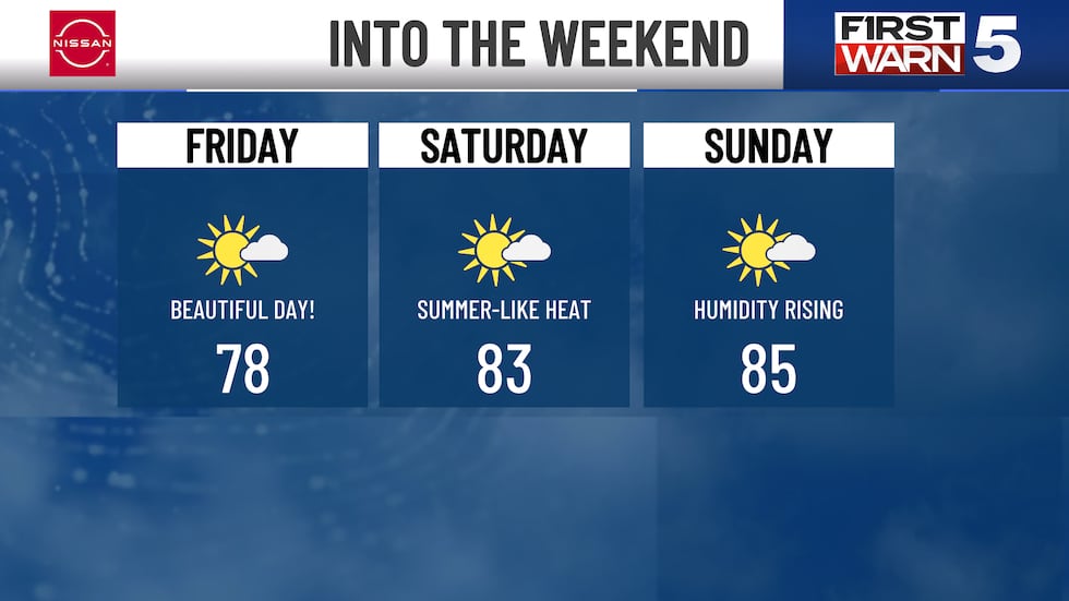
FRIDAY: The nicest day in the forecast! Highs in the upper 70s with sunny skies and light winds.
THE WEEKEND: Feeling more like summer with highs in the mid-80s and increasing humidity. Both days will be largely dry, though each has a low 20% chance for a brief shower or thunderstorm.
NEXT WEEK: June heat continues with highs in the 80s. Humidity really picks up by Tuesday, which may also see scattered storms. We are First Warning Wednesday for an increasing chance of widespread rain and storms.
Copyright 2025 KCTV. All rights reserved.


