FORECAST: Sunshine returns along with more rain. Plus, First Warns for Wednesday & Thursday
We have been making up for a dry first half of May recently, with rounds of rain coming and going since late last week. While this evening could see a few sprinkles, our next meaningful rain will return Wednesday evening. We are First Warning that outdoor activities may be disrupted by rain after 6 pm Wednesday, and Thursday morning could see be wet. The First Warn will end by 10 am Thursday as drier weather moves back in.
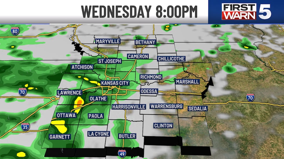
WEDNESDAY: FIRST WARN - Cool and sunny morning with temperatures in the low to mid 50s. The afternoon will be partly cloudy with warmer highs near 70 and northwest winds at 5-10 mph. While much of the day looks great, we are First Warning for scattered rain and a few thunderstorms after 6 pm. Severe weather is not expected.
THURSDAY: FIRST WARN - Scattered morning rain through 10 a.m., then drier with only a 20% rain chance for the afternoon. Partly cloudy with highs near 70.
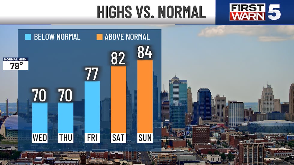
FRIDAY: Mostly sunny, warm highs in the upper 70s, and light breezes. A wonderful day!
THE WEEKEND: Warmer with highs in the low to mid-80s both days. We will also see lots of sunshine, though there is a chance for scattered storms late Saturday afternoon and evening. At this point, they look most likely west of Kansas City, but a few may sneak in with a 30% chance for rain. Sunday is dry.
Copyright 2025 KCTV. All rights reserved.


