FORECAST: First Warn for heavy rain & strong storms into Tuesday
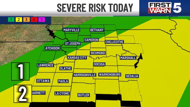
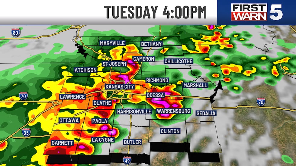
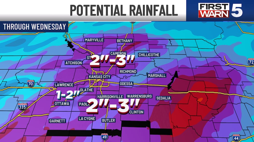
We have been First Warning Tuesday for storms since the middle of last week, and there is a 100% chance for rain with this very wet system. In fact, you may be woken up by thunder while sleeping tonight as the first round moves in. This will linger into Tuesday morning before we catch a break. A second round of storms will begin around 2 pm Tuesday and linger into the evening. There is a Level 2/5 risk for strong to severe storms with this second round. The primary risks are hail and gusty winds to 60 mph, but flooding rain is also a possibility. We are under a Flood Watch from Tuesday morning through Wednesday morning, where widespread rain totals of 1-3″ are expected.
TUESDAY: FIRST WARN - Rain likely early in the morning, then a break around lunchtime. A second round of stronger storms from 2-8 pm. Highs in the mid-70s with southwest winds at 10-15 mph.
WEDNESDAY: Pleasant with partly cloudy skies and highs in the mid-70s. The rain chance is low at 20%.
THURSDAY: Pleasant with highs in the mid-70s. A few spotty showers are possible, rain chances are 30%.
FRIDAY: FIRST WARN - Rain likely in the morning, but trending drier for the afternoon. Highs will be in the upper 70s.
THE WEEKEND: Highs near 80 with generally low rain chances at 20% for Saturday and 30% for Sunday.
Copyright 2025 KCTV. All rights reserved.